Maps of Alaska

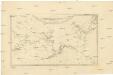
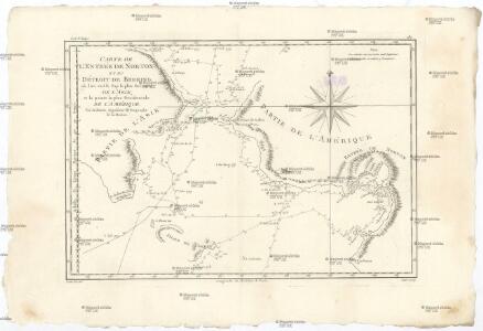
Carte de l'entrée de Norton et du Détroit de Bhering, ou l'on voit le cap le plus oriental de l'Asie, et la pointe la plus occidentale de l'Amérique
1 : 1780000 Asie východní Bonne, Rigobert André
Scandinavia.
1 : 3300000 Thomson, John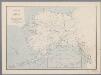
Map of Alaska
1 : 5000000 [Washington, D.C. : U.S. Geological Survey]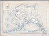
Map of Alaska
1 : 5000000 [Washington, D.C. : United States Department of the Interior, Geological Survey]
Territory of Alaska.
1 : 7500000 Colton, G.W.
Behring's Sea and Arctic Ocean : from surveys of the U.S. North Pacific Surveying Expedition in 1855, Commander John Rodgers U.S.N. commanding and from Russian and English authorities
1 : 4400000 United States. Hydrographic Office U.S. Navy, Hydrographic Office
Alaska.
1 : 8400000 Rand McNally and Company
Alaska.
1 : 8200000 Rand McNally and Company
Alaska.
1 : 7315000 Colton, G. Woolworth
Map of Alaska / comp. by Alaska Branch
1 : 5000000 United States Geological Survey. Alaskan Branch [Washington, D.C. : U.S. Geological Survey]
Alaska.
1 : 3817000 U.S. General Land Office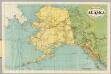
Rand-McNally Official 24x36 Map Of Alaska.
1 : 3611520 Rand McNally and Company
Map Of Alaska.
1 : 3484800 Punnett Brothers
Alaska.
1 : 8200000 Rand McNally and Company
North America...N.W. Sheet.
1 : 7500000 Tanner, Henry S.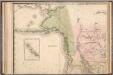
North America...N.W. Sheet.
1 : 7500000 Tanner, Henry S.
Territory of Alaska.
1 : 7500000 Colton, G.W.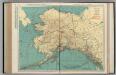
Alaska.
1 : 4055000 Rand McNally and Company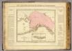
Possessions russes.
1 : 7600000 Pierron, Jean Antoine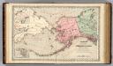
Territory of Alaska (Russian America).
1 : 7000000 Colton, G.W.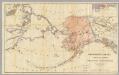
Northwestern America Showing The Territory Ceded By Russia To The United States.
1 : 5000000 Sumner, Charles
NW America.
1 : 11900000 Mitchell, Samuel Augustus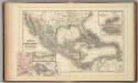
Mexico, Central America, West Indies.
1 : 12000000 Mitchell, Samuel Augustus
NW America.
1 : 11900000 Mitchell, Samuel Augustus Jr.
NW America.
1 : 11900000 Mitchell, Samuel Augustus
NW America.
1 : 11900000 Mitchell, Samuel Augustus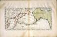
Carte der Entdekvngen zwischen Sibirien und America bis auf das Jahr 1780
1 Karte : Kupferdruck ; 18 x 40 cm Pallas s.n.
Partie orientale de l'empire de Russie / projettée et assujetie aux observations astronomiques post
1 : 13000000 1 Karte : Kupferdruck ; 42 x 30 cm Bonne, Rigobert chez Lattré ruë St. Jacques à la ville de Bordeaux
[Historisch-geographischer Atlas zu den allgemeinen Geschichtswerken von C. v. Rotteck, Pölitz u. Becker] : Russland zur Uebersicht dieses Staates
von Julius Loewenberg Lithographie von B. Herder in Freiburg im Breisgau [Freiburg im Breisgau] : [Herder]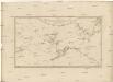
Karte von den n.w. amerikanischen und n.oe. asiatischen Küsten
Severní Amerika-oblast severozápadní Roberts, Heinrich Lackner, I. C. von F.A. Schraembl