Maps of Tubuaï
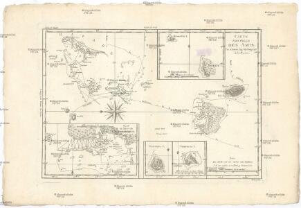
Carte des Isles des Amis
1 : 690000 Francouzská Polynésie Bonne, Rigobert André
Low Archipelago or Paumotu Group.
1 : 7300000 United States Exploring Expedition (1838-1842)
Iles des Amis. Oceanique no. 47.
1 : 1641836 Vandermaelen, Philippe, 1795-1869
[Ost-Polynesien]
Hand-Atlas über alle Theile der Erde nach dem neuesten Zustande und über das Weltgebäude Stieler, Adolf bei Justus Perthes
Map of the country between Washington & Pittsburg refering to the contemplated Chesapeake & Ohio Canal and its general route and profile, October 1826 / reduced from the general map annexed to the report upon the comtemplated canal & drawn, b
from Parts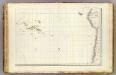
Oceanie 4.
1 : 15500000 Brue, Adrien Hubert, 1786-1832
Australia.
1 : 5100000 Rand McNally and Company
America Meridionalis
1 : 27500000 L'Isle, Guillaume de, 1675-1726 C. Weigelii Sen. Hæredum
Grand Ocean a l'E. et SE. de la Nouvelle Guinee.
1 : 13000000 Mourelle de la Rua, Francisco Antonio, 1750-1820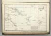
Route of the Spanish frigate la Princesa.
1 : 17500000 La Perouse, Jean-Francois de Galaup, comte de, 1741-1788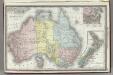
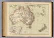
Australia.
1 : 11000000 Rand McNally and Company
Mexico, or, New Spain : divided into the audiance of Guadalayara, Mexico, and Guatimala, Florida.
from New & accurate description of the earth in all its empires, kingdoms and states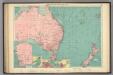
Australian, N.Z. ports.
1 : 10000000 Philip, George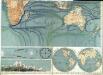
Physikalische Wandkarte der Erde in Merkartor's Projection

[Polynesien und der Grosse Ocean, östliches Blatt]
Handatlas über alle Theile der Erde und über das Weltgebäude Stieler, Adolf Justus Perthes
Oceanica, Australia, New Zealand.
1 : 87639000 Fisher, Richard Swainson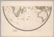
Southern Half, Eastern Hemisphere.
1 : 22500000 Brue, Adrien Hubert, 1786-1832
[Polynesien und der Grosse Ocean (östliches Blatt)]
Adolf Stieler's Handatlas über alle Theile der Erde und über das Weltgebäude Stieler, Adolf Justus Perthes
[Polynesien und der Grosse Ocean, Östliches Blatt]
Hand-Atlas über alle Theile der Erde und über das Weltgebäude Stieler, Adolf Justus Perthes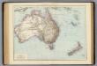
Australien, Neuseeland.
1 : 13500000 Andree, Richard

Austrálie a Polynesie
Australia, New Zealand.
1 : 13500000 Andree, Richard; Times (London, England)
New Holland, And New Zealand.
1 : 19800000 Greenleaf, Jeremiah
New Holland, And New Zealand.
1 : 19641600 Greenleaf, Jeremiah
Kaart der Vriendelyke Eilanden / [getekend door] R. van Wijk
Dordrecht : J. de Vos
Australie, Nlle. Zelande.
1 : 18700000 Garnier, F. A., 1803-1863
Kaart der Vriendelyke eilanden : behoorende tot de door het Provinciaal Utrechtsch Genootschap bekroonde Verhandeling van R.G. Bennet en J. van Wyk Rz.
1 : 9000000 R. van Wyk Jz. del. Te Dordrecht : by J. de Vos & Co.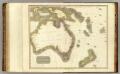
New Holland, Asiatic isles.
1 : 12000000 Thomson, John