Maps of Malay Archipelago

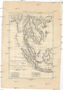
La presqu'isle de l'Indie au dela du Gange, avec l'archipel des Indes
1 : 12640000 Asie jihovýchodní Bonne, Rigobert André
Hinterindien nebst den Hinterindischen Inseln
1 : 10000000 entworfen und gezeichnet im Jahre 1826 von C. F. Weiland, nach Crawfurd, Kolf und Krusenstern umgearb. und berichtigt 1832, und im Jahre 1838, abermals nach Raffles und Berghaus' Atlas von Asien theilweis umgearb. und berichtigt Weimar : Verlag des Geograph. Instituts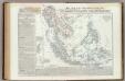
Malesia ossia Arcipelago Indiano, ed India-Transgangetica.
1 : 11300000 Marzolla, Benedetto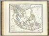
Hinter Indien.
1 : 10000000 Weiland, C. F. (Carl Ferdinand), d. 1847
Eastern Islands, Birmah &c.
1 : 15200000 Hughes, William
Ostindien
Asie jižní im Verlage des Kunst u. Industrie Comptoirs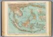
95-96. Indocina, Siam, Arcipelago Malese.
1 : 10000000 Touring club italiano
Niederländisch-Indien
1 : 13000000 Druck und Verlag von Carl Flemming. Glogau : Carl Flemming
Hinterindien die Philippinen, Molukken und Sunda Inseln
Schul-Atlas in 36 Karten Völter, Daniel Verlag der J.M. Dannheimer'schen Buchhandlung
Niederländisch-Indien / Druck und Verlag von Carl Flemming
Glogau : Carl Flemming
East India Isles.
1 : 11404800 Burr, David H., 1803-1875
East India Isles.
1 : 15200000 Greenleaf, Jeremiah
East India Isles.
1 : 15200000 Greenleaf, Jeremiah
Ostindische Inseln
Adolf Stieler's Handatlas über alle Theile der Erde und über das Weltgebäude Stieler, Adolf Justus Perthes
Charte von Ostindien jenseits des Ganges
Zadní Indie
CHARTE von OSTINDIEN Jenseits des Ganges
Ganga-oblast (Indie a Bangladéš)
Ostindische Inseln
1 : 12500000 Filipíny Berghaus, Herm. Eberhardt, H. Justus Perthes
East Indian ports.
1 : 10000000 Philip, George
Kaart van den Oost-Indischen Archipel
[Java und Madoera, geologische Detailkarten und Profile] Verbeek, R. D. M. Joh. C. Stemler Cz.
East India Islands.
1 : 21500000 Arrowsmith, Aaron
East India Islands.
1 : 21500000 Arrowsmith, Aaron
Hinterindien und Malaien-Archipel
1 : 18000000 Malajsie Meyer, Joseph Bibliographisches Institut
East Indies.
1 : 12000000 Colton, G.W.
Archipel Asiatique.
1 : 10000000 Vivien St Martin, L.
Kaert van de Molocques : zeer correckt afgheteyckent met allen zijn eylanden ende sterckten, met een afbeeldinghe van de Straat van Botton / [Jan Cornelisz. Moy?]
[S.l. : s.n.]
East Indies.
1 : 12672000 Colton, G.W.
East Indies.
1 : 11000000 Colton, G.W.
Die Ostindischen Inseln
Handatlas über alle Theile der Erde und über das Weltgebäude Stieler, Adolf Justus Perthes
Indo-Chine et Archipel D'Asie.
1 : 14400000 Migeon, J.