Maps of Poland

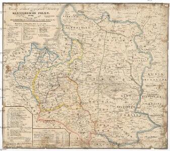
Historisch- statistisch- geographische Darstellung Koenigreichs Polen, 1770, 1773, 1793, 1795, 1807, 1815
Bělorusko Schlicht, Rudolph Rudolph Schlicht
Pohlen und Lithauen
1 : 2775000 Bělorusko Engelman, J. W.
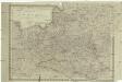
Das Königreich Polen nebst den angränzenden Ländern
1 : 1910000 Polsko Sotzmann, Daniel Friedrich im Verlag der Schneider u. Weigelschen Kunst- und Buchhandlung
Neueste Karte von Polen und Litauen
1 : 2100000 Evropa střední a východní Müller, Franz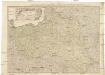
Neueste Karte von Polen und Litauen
1 : 2100000 Evropa střední a východní Müller, Franz Artaria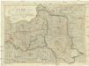
Polen unter Oestereich, Russland und Preussen getheilt
1 : 2100000 Evropa střední a východní Mollo, Tranquillo T. Mollo
Mappa Polski i krajow okolicznych
1 : 3810000 Evropa východní Sławinski, J.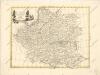
La polonia divisa ne ́suoi Palatinati
Königreich Pohlen
1 : 2055000 Bělorusko Schönberg, Johann Müller, And. Johann Schönberg
Die Republik Polen nach ihrem Bestande im Jahre 1772 und das Königreich Polen seit dem Jahre 1815
1 : 5890000 Polsko Kleinknecht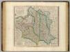
Poland, Lithuania.
1 : 2600000 Cary, John, ca. 1754-1835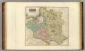
Poland.
1 : 2500000 Thomson, John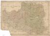
Polen
Bělorusko
Poland.
1 : 3000000 Bowen, Frances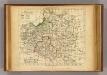
La Pologne.
1 : 6000000 Delamarche, Charles Francois; Lattre, Jean
Carte Generale & Itineraire de Pologne
1 : 5000000 Mollova mapová sbírka Dorn, Sebastian Gröll, Michael
Charte von Polen
1 : 1850000 Bělorusko Güssefeld, Franz L. Geograph. Institut
Karte von Polen
1 : 1900000 Bělorusko Reilly, Franz Johann Josef von Amon, Anton von Franz Ioh. Ios. von Reilly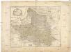
Karte von Polen
1 : 1900000 Bělorusko Reilly, Franz Johann Josef von Amon, Anton Franz Ioh. Ios. von Reilly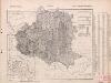
Poland: Natural increase
1 : 3000000 Series of maps on various aspects of Poland. Natural increase. Annual increase of population. War Office
Carte des partages de la Pologne en 1772, 1793 et 1795
1 Karte : Typometrie ; 24 x 28 cm Haas chez G. Haas et chez J. Decker imprimeur libraire =Johann Heinrich Deckers Erben?
Carte des partages de la Pologne en 1772, 1793 et 1795
1 Karte : Typometrie ; 24 x 28 cm Haas chez G. Haas et chez J. Decker imprimeur libraire =Johann Heinrich Deckers Erben?
Polen nach der Theilung im Jahre 1815, 1793, 1795 ; Die Theilung von Polen im Jahre 1772
Polsko
Karte von Polen
1 : 1900000 Bělorusko Amon, Anton von Franz Ioh. Ios. von Reilly
Poloniae Regnum ut et Magni Ducat. Lithuaniae
1 : 8500000 Mollova mapová sbírka Dorn, Sebastian Raspe, Gabriel Nikolaus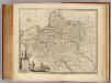
Poland, Lithuania &c.
1 : 3050000 Bowen, Emanuel
Carte historique de la Pologne.
1 : 5600000 Malte-Brun, Conrad, 1775-1826