Maps of Northern European Plain

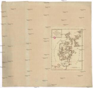
Die Orkney's oder die Orkadischen Inseln
Orkneje (Skotsko) Seutter, Matthäus Bowles, Carington
Museumskart 167: Kysten fra Osterøy til Langesund
1 : 750000 Lucas Janszoon Waghenaer
Museumskart 95: Kysten fra Fusafjorden til Tresfjorden og videre inn i Geirangerfjorden
1 : 70000
Carte des iles britanniques ou Royaume-Uni de la Grande Bretagne et d'Irlande, 2
2 Blätter : je 50 x 39 cm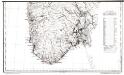
Folketetthetskart over Sør-Norge (sør)
1 : 1000000 Alfred Söderlund Statistiske Centralbyrå, Kristiania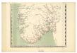
Spesielle kart 88-2: Rikstelegrafens og private telefonselskapers linjeruter i det sydlige Norge
Kristian Petersen Ukjent
Statistikk kart 2-2: Folkemængdekart over Norge
1 : 800000
Regnum Norwegiae accurata et novissima delineatione
Norsko Lotter, Tobias Conrad Zatta, Antonio sumptibus Tobiae Conradi Lotter
Regnum Norwegiae accurata et novissima delineatione
Norsko Lotter, Tobias Conrad Zatta, Antonio sumptibus Tobiae Conradi Lotter
Feuille 15 (A III), uit: Carte géologique internationale de l'Europe : la carte, votée au congrès géologique international de Bologne en 1881, est exécutée conformément aux décisions d'une commission internationale, avec le concours des gouvernements, sous le dir. de M.M. Beyrich et Hauchecorne
Annotatie: Blad 48 gamme des couleurs; blad 49: bladwijzer en titelblad Heinrich Ernst Beyrich 1815-1896; Wi. Hauchecorne Berlin : Reimer / (Berlin: Institut lithographique)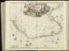
[126][129] Norvegiae Maritimae ... Pascaert van Noorwegen ..., uit: Atlas sive Descriptio terrarum orbis
Annotatie: Gedigitaliseerde versie. Amsterdam. Heiloo : Picturae (vervaardiger), 2015. tiff-bestand. Gedigitaliseerd: 07-01-2015; Origineel: Universiteitsbibliotheek Vrije Universiteit (XL.05127.-) ; Netherlands; Titelpagina ontbreekt Wit, Frederik de Amsterdam : Frederick de Wit

Die britischen Inseln
Velká Británie Wyld, James Kitchin, Thomas
Charte vom Koenigreich Norwegen
Norsko Güssefeld, Franz L. Wangensteen, O. A. bey den Homännischen Erben
Spesielle kart 18 Sør-vest: Telegrafkart over Norge
1 : 1000000 Den Private Opmaaling, Kristiania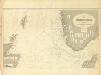
Museumskart 217-6: Kart over Nordsjøen
1 : 500000 S. A. Aarnes Den Geografiske Opmaaling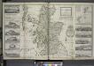
The north part of Great Britain called Scotland.
from The world described, or, A new and correct sett of maps : shewing the kingdoms and states in all the known parts of the earth, with the principal cities, and most considerable towns in the world ... / ... by Herman Moll, geographer ...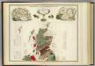
Geological, palaeontological map British Islands.
1 : 1550000 Johnston, Alexander Keith, 1804-1871
Spesielle kart nr 117-1: Geistlig inndelingskart over sà ̧r-Norge
1 : 1000
Norge 145: Vei Kaart over Norge
1 : 500000 H. G. Bloch | kobberstikk av S. Andersen
Spesielle kart 63: Pflanzengeographische Karte Über Das Königreich Norwegen, blad 4
1 : 1000000 F. C. Schübeler
Spesielle kart 78: Valgkredskart over det sydlige Norge visende Herreds og Valgkredsinddeling...
1 : 1000000 F. Abrahamson | K. Gleditsch
Spesielle kart 2-4: Norges jernbaner i 1869
1 : 1000000
Spesielle kart 2-1: Norges jernbaner i 1851
1 : 1000000
Episcopatus Bergensis.
from Atlas major, sive, Cosmographia universalis, adeoque orbis terrestris, maritimus, antiquus & coelestis : in quo tabulae cum descriptionibus omnium regionum orbis terrestris novi & antiqui amplissimè exhibentur.
Spesielle kart 2-5: Norges jernbaner i 1876
1 : 1000000
Spesielle kart 65-4: Oversigtskart over de paa den norske Kyst anbragte Fyre
1 : 1000000
Spesielle kart 26: Oversigtskart. Direkte Bergensbane
1 : 3200000
Spesielle kart 173a: Oversiktskart over Nivellementer i SÃ ̧r-Norge
1 : 100000