Maps of Královehradecký

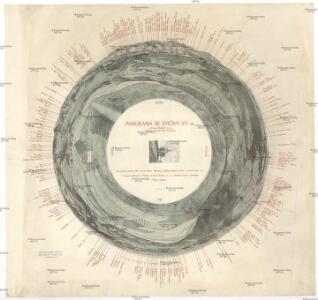
Panorama se Zvičiny 671 m. u Dvora Králové n. L
Bílá Třemešná (Česko) Pacelt, Čeněk Klub českých turistů
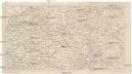
Spezial-Karte des Jičiner Kreis...
Charte ehermaliger Burgen & Vesten im Bidžower & Koeniggrätzer Kreise Böhmens
1 : 555000 Nový Bydžov-oblast (Česko) Heber, Franz Alexander Röhrich, P. C.W. Medau
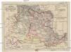
Kraj Hradecký

A. Bidschover und B. Königingratzer Kreis samt der Grafschaft Glatz
1 : 200000 Hradec Králové-oblast (Česko) Peter Franza
A. Bidschover und B. Königingratzer Kreis samt der Grafschaft Glatz
1 : 200000 Hradec Králové-oblast (Česko) Peter Franza
Kraj hradecký

Regni Bohemiae Circulus Reginohradecensis
1 : 253000 Mollova mapová sbírka Hauer, Daniel Adam Homann, Johann Baptista - dědici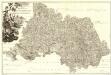
Provincia Reginohradecensis et Comitatus Glacensis
1 : 233000 Mollova mapová sbírka Erber, Bernardinus Winkler, Johann Christoph Kurzböck, Josef von
Königingratzer Kreis samt der Grafschaft Glatz
1 : 200000 Hradec Králové-oblast (Česko) Berndt, Johann Christoph Anto. Elsenwanger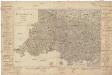
Königingratzer Kreis samt der Grafschaft Glatz
1 : 200000 Hradec Králové-oblast (Česko) Kreibich, František Jakub Jindřich Elsenwanger, Antonín Anto. Elsenwanger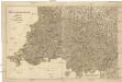
Königingratzer Kreis samt der Grafschaft Glatz
1 : 200000 Hradec Králové-oblast (Česko) Kreibich, František Jakub Jindřich Berndt, Johann Christoph
Königingratzer Kreis samt der Grafschaft Glatz
Hradec Králové-oblast (Česko) A. Elsenwanger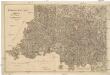
Königingratzer Kreis samt der Grafschaft Glatz
Hradec Králové-oblast (Česko) Kreibich, František Jakub Jindřich Elsenwanger, Antonín Anto. Elsenwanger
Generalkarte zum Kriegsspielplan von Trautenau

Special-Karte des Jičiner Kreis - resp. politischen Verwaltungs Bezirkes in Böhmen
1 : 231000 Jičín-oblast (Česko) Schmidt, Eduard Wend. Morauer
Special-Karte des Jičiner Kreis - resp. politischen Verwaltungs Bezirkes in Böhmen
1 : 230000 Jičín-oblast (Česko) Schmidt, Eduard Wend. Morauer
Special-Karte des Jičiner Kreis, resp. politischen Verwaltungs Bezirkes in Böhmen
1 : 231000 Jičín-oblast (Česko) Schmidt, Eduard Wend. Morauer
Charte vom Königgrätzer Kreise ...

Special-Karte des Königgrätzer Kreis - resp. politischen Verwaltungsbezirkes in Boehmen
1 : 230000 Hradec Králové-oblast (Česko) Schmidt, Eduard Wend. Morauer
Special-Karte des Königgrätzer Kreis - resp. politischen Verwaltungsbezirkes in Boehmen
1 : 231000 Hradec Králové-oblast (Česko) Schmidt, Eduard Wend. Morauer
Special-Karte des Königgrätzer Kreis - resp. politischen Verwaltungsbezirkes in Boehmen
1 : 230000 Hradec Králové-oblast (Česko) Schmidt, Eduard Wend. Morauer
Mapa království Českého 8.
[Nová Mapa království Českého]
1 : 200000 Čechy východní (Česko) Kotyška, Václav Hanf, Norbert Bursík & Kohout
[A. Bidschover und B. Königingratzer Kreis samt der Grafschaft Glatz]
1 : 175000 Hradec Králové-oblast (Česko) Franza, Petr Peter franza [sic]
A. Bidschover und B. Königingratzer Kreis samt der Grafschaft Glatz
1 : 175000 Hradec Králové-oblast (Česko)
Special-Karte des Königgrätzer Kreis, resp. politischen Verwaltungsbezirkes in Boehmen
1 : 231000 Hradec Králové-oblast (Česko) Schmidt, Eduard Steyrer, Fr. C. Wend. Morauer
Spezial-Karte des Königgrätzer Kreis...

144. Lewin, uit: Topographische Uebersichtskarte des Deutschen Reiches / herausgegeben v. d. Kartogr. Abt. d. Königl. Preuß. Landesaufnahme
1 : 200000 titelvariant: Topogr. Übersichtskarte des Deutschen Reiches; Annotatie: Titel boven bladen ook: Topogr. Übersichtskarte des Deutschen Reiches; Annotatie geografische gegevens: Op elk blad twee maatstokken: 10 Kilometer = 5,5 cm; 1 geogr. Meile = 3,6 cm; Legenda onder op elk blad Königlich Preußische Landesaufnahme. Kartographische Abtheilung [S.l : Königlich Preußische Landesaufnahme, Kartographische Abtheilung]