Maps of Chukchi Range

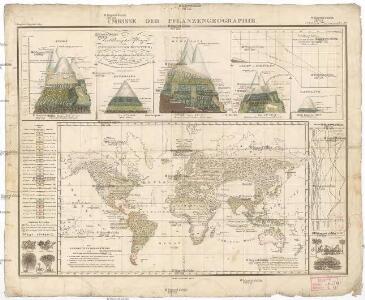
Umrisse der Pflanzengeographie
země světa Schelle, Fr. Ausfeld, Johann Carl J. Perthes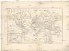
Erdkarte in Mercators Projection
země světa Grasmüller, E. Goss, Fr. von der lit. artist. Anstalt
Darstellung des Sonnensystems
země světa Pinter, Franz von Liechtenstern, Joseph Marx von
Die Berge und ihre Höhen
země světa Wilh. Nitzschke
Vergleichende übersicht der grössten ströme der Erde
1 : 11240000 země světa
Suite de la carte de la Sibérie et le pays de Kamtschatka
1 : 14500000 1 Karte : Kupferdruck ; 23 x 25 cm [Bellin]
Suite de la carte de la Sibérie et le pays de Kamtschatka
1 : 14500000 1 Karte : Kupferdruck ; 23 x 25 cm [Bellin]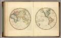
Eastern Hemisphere.
1 : 123000000 Lucas, Fielding Jr.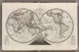
Mappemonde en Deux Hemispheres.
1 : 120000000 Monin, C.V.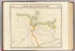
Partie, Russie d'Asie. Asie 10.
1 : 1641836 Vandermaelen, Philippe, 1795-1869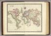
World.
1 : 100000000 Teesdale, Henry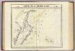
Partie, Russie d'Asie. Asie 28.
1 : 1641836 Vandermaelen, Philippe, 1795-1869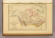
Amerique Russe, Nouvelle Bretagne et Canada.
1 : 23000000 Malte-Brun, Conrad, 1775-1826
Imperii Russici et Tartariae universae tam majoris et Asiaticae, qvam minoris et Europaeae tabvla
1 : 16820000 Asie Hase, Johann Matthias Schneider, R. A. impensis Homannianorum Heredum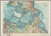
Arctic. Pergamon World Atlas.
1 : 20000000 Polish Army Topography Service
Nord Pol.
1 : 32000000 Meyer, Joseph, 1796-1856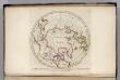
North Pole countries.
1 : 40000000 Carey, Mathew
North Pole countries.
1 : 40000000 Carey, Mathew
Countries situate about the North Pole.
1 : 41000000 Carey, Mathew
Map of the Countries situate about the North Pole.
1 : 40000000 Carey, Mathew
Map of the Countries situate about the North Pole.
1 : 40000000 Carey, Mathew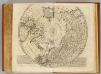
North Pole.
1 : 21500000 Bowen, Emanuel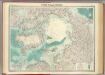
North Polar regions.
1 : 14000000 John Bartholomew and Son
Polar-Karte
1 : 27000000 Arktida Stieler, Adolf Justus Perthes
Map of the countries round the North Pole
1 : 15000000 Arktida Arrowsmith, John John Arrowsmith
A new [and] accurate map of the North Pole
1 Karte : Kupferdruck ; 37 x 40 cm Bowen s.n.
Poli arctici, et circumiacentium terrarum descriptio novissima
1 Karte : Kupferdruck ; Durchmesser 43 cm, Bildgrösse 43 x 49 cm Wit Louis Renard
Nova et accvrata poli arctici et terrarum circum iacentium descriptio
1 Karte : Kupferdruck ; 40 x 52 cm Janssonius apud Ioannem Ianssonium
Nova et accvrata poli arctici et terrarum circum iacentium descriptio
1 Karte : Kupferdruck ; 39 x 51 cm Valck; Schenk apud Gerardi Valk et Petri Schenk
Poli arctici, et circumiacentium terrarum descriptio novissima
1 Karte : Kupferdruck ; Durchmesser 42 cm, Bildgrösse 43 x 49 cm Wit by Frederick de Wit in de Calverstraet aen den Dam in de Witte Pascaert