Maps of Pevek urban district
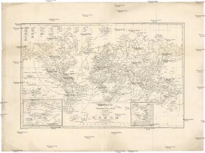
Erdkarte in Mercators Projection
země světa Grasmüller, E. Goss, Fr. von der lit. artist. Anstalt
Darstellung des Sonnensystems
země světa Pinter, Franz von Liechtenstern, Joseph Marx von
Umrisse der Pflanzengeographie
země světa Schelle, Fr. Ausfeld, Johann Carl J. Perthes
Partie, Russie d'Asie. Asie 10.
1 : 1641836 Vandermaelen, Philippe, 1795-1869
Suite de la carte de la Sibérie et le pays de Kamtschatka
1 : 14500000 1 Karte : Kupferdruck ; 23 x 25 cm [Bellin]
Suite de la carte de la Sibérie et le pays de Kamtschatka
1 : 14500000 1 Karte : Kupferdruck ; 23 x 25 cm [Bellin]
Die Berge und ihre Höhen
země světa Wilh. Nitzschke
Vergleichende übersicht der grössten ströme der Erde
1 : 11240000 země světa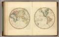
Eastern Hemisphere.
1 : 123000000 Lucas, Fielding Jr.
Partie, Russie d'Asie. Asie 18.
1 : 1641836 Vandermaelen, Philippe, 1795-1869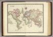
World.
1 : 100000000 Teesdale, Henry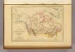
Amerique Russe, Nouvelle Bretagne et Canada.
1 : 23000000 Malte-Brun, Conrad, 1775-1826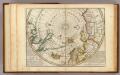
Map of the North Pole and territories near it.
1 : 26000000 Moll, Herman, d. 1732
Northern America.
1 : 20000000 Colton, G.W.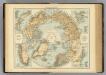
N. Polar Regions.
1 : 20000000 Andree, Richard; Times (London, England)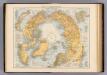
Nordpolarregion.
1 : 20000000 Andree, Richard
Nordpolargebiete
1 : 20000000 Arktida Velhagen & Klasing
Physical map of the Arctic
1 : 20000000 Arktida American geographical society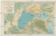
Bathymetric map of the Arctic basin
1 : 20000000 Severní ledový oceán Nansen, Fridtjof American geographical society
Nord-Polar-Karte
1 : 20000000 Arktida Berghaus, Heinrich Karl Wilhelm Habenicht, Hermann Justus Perthes
Nansen's Nordpolfahrt 1893-1896
1 : 30000000 Arktida Umlauft, Friedrich Kartogr. Anstalt von G. Freytag & Berndt
Carta delle Terre polari Artiche
1 : 11800000 Arktida Miniscalchi-Erizzo, Francesco P. Ripamonti Carpano
Essai d'une carte polaire arctique
1 Karte : Kupferdruck ; Durchmesser 46 cm Robert de Vaugondy; Dussy chés l'auteur quai de l'horloge du Palais près le Pont neuf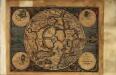
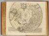
Septentrionalivm terrarum descriptio
1 Karte : Kupferdruck ; Durchmesser 17 cm, Bildgrösse 18 x 25 cm Mercator Cloppenburgh
Septentrionalivm terrarum descrıptio
1 Karte : Kupferdruck ; Durchmesser 34 cm, Bildgrösse 35 x 38 cm Mercator; Hondius Jodocus Hondius
Septentrionalivm terrarum descrıptio
1 Karte : Kupferdruck ; Durchmesser 34 cm, Bildgrösse 35 x 38 cm Mercator s.n.
Polvs arcticvs siue tract[us] septentrionalis
1 Karte : Kupferdruck ; Durchmesser 21 cm, Bildgrösse 22 x 28 cm Quad; Bussemacher ex officina typographica Jani Bussemechers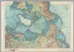
Arctic. Pergamon World Atlas.
1 : 20000000 Polish Army Topography Service
Nord Pol.
1 : 32000000 Meyer, Joseph, 1796-1856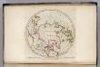
North Pole countries.
1 : 40000000 Carey, Mathew
North Pole countries.
1 : 40000000 Carey, Mathew
Countries situate about the North Pole.
1 : 41000000 Carey, Mathew
Map of the Countries situate about the North Pole.
1 : 40000000 Carey, Mathew
Map of the Countries situate about the North Pole.
1 : 40000000 Carey, Mathew