Maps of okres Jihlava

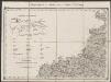
Karte der Iglauer Sprachinsel und der südwestmährischen Sprachgrenze auf Grund der Volkszählung v. 31. Dec. 1880
1 : 300000 Jihlava-oblast (Česko) Held, Franz Historisch-statistische Section der k. k. mährisch-schlesische Ackerbaugesellschaft
Iglau 118, uit: Special-Karte von Mittel-Europa / nach amtlichen Quellen bearbeitet von W. Liebenow
1 : 300000 titelvariant: W. Liebenow's Mittel-Europa; Annotatie: Titel boven de bladen: W. Liebenow's Mittel-Europa Johannes Wilhelm Liebenow 1822-1897 Frankfurt a. M. : Ludwig Ravenstein
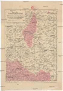
Der Iglauer Kreis
1 : 199000 Jihlava-oblast (Česko) Schenkl, Conrad Philipp Winiker, Karel von Carl Winiker
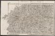
[Die Markgraftschaft Mähren]
1 : 200000 Jihlava-oblast (Česko) Schenkl, Conrad Philipp Carl Winiker
Die Markgraftschaft Mähren
1 : 22000 Jihlava-oblast (Česko) Schenkl, Conrad Philipp Carl Viniker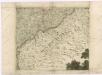
Müllerova mapa Čech
1 : 132000
Marchionatvs Moraviae Circvlvs Iglaviensis
1 : 233300 Mollova mapová sbírka Müller, Johann Christoph Homann, Johann Baptista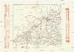
Komunikační mapa země Moravskoslezské
1 : 100000 Jihlava (Česko : oblast) Morslez. zem. výbor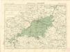
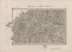
Politický okres Jihlavský
Umgebungen von Teltsch und Trebitsch
1 : 144000 K.K. Militärisches Geographisches Institut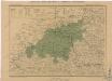
Generální mapa okresních hejtmanství
II. vojenské mapování 12
1 : 144000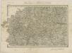
II. vojenské mapování 12
1 : 144000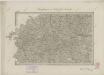
II. vojenské mapování 12
1 : 144000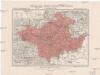
Generální mapa okresního hejtmanství Něm. Brodského
1 : 220000 Havlíčkův Brod-oblast (Česko) Wagner, Jan Eduard F. Kytka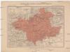
Generální mapa okresního hejtmanství Něm. Brodského
1 : 220000 Havlíčkův Brod-oblast (Česko) Wagner, Jan Eduard F. Kytka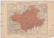
Generalkarte der Bezirkshauptmannschaft Deutschbrod
1 : 220000 Havlíčkův Brod-oblast (Česko) Wagner, Jan Eduard F. Kytka
Iglau.
from Spezialkarte der osterreichisch-ungarischen Monarchie.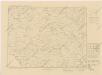
Karte der Gemeindegrenzen

Datschitz und Mhr. Budwitz.
from Spezialkarte der osterreichisch-ungarischen Monarchie.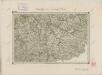
II. vojenské mapování 27
1 : 144000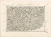
Special - Karte des Koenigreiches Boehmen

Generální mapa okresních hejtmanství

Deutschbrod.
from Spezialkarte der osterreichisch-ungarischen Monarchie.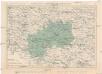
Politický okres moravskobudějovický
1 : 200000 Moravské Budějovice-oblast (Česko) Plesinger, Václav V. Plesinger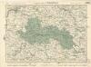
Soubor map politických okresů

Generální mapa okresních hejtmanství
II. vojenské mapování 7
1 : 144000
II. vojenské mapování 7
1 : 144000