Maps of Islington

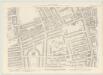
Insurance Plan of London Vol. xi Regent's Canal and Vicinity: Key Plan 2
1 : 4800 This "key plan" indicates coverage of the Goad 1891 series of fire insurance maps of London that were originally produced to aid insurance companies in assessing fire risks. The building footprints, their use (commercial, residential, educational, etc.), the number of floors and the height of the building, as well as construction materials (and thus risk of burning) and special fire hazards (chemicals, kilns, ovens) were documented in order to estimate premiums. Names of individual businesses, property lines, and addresses were also often recorded. Together these maps provide a rich historical shapshot of the commercial activity and urban landscape of towns and cities at the time. The British Library holds a comprehensive collection of fire insurance plans produced by the London-based firm Charles E. Goad Ltd. dating back to 1885. These plans were made for most important towns and cities of the British Isles at the scales of 1:480 (1 inch to 40 feet), as well as many foreign towns at 1:600 (1 inch to 50 feet). Chas E Goad Limited Chas E Goad Limited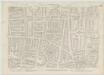
London VII.24 - OS London Town Plan
1 : 1056 Topographic maps Ordnance Survey Ordnance Survey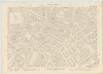
London VII.25 - OS London Town Plan
1 : 1056 Topographic maps Ordnance Survey Ordnance Survey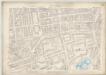
London VII.34 - OS London Town Plan
1 : 1056 Topographic maps Ordnance Survey Ordnance Survey
London VII.35 - OS London Town Plan
1 : 1056 Topographic maps Ordnance Survey Ordnance Survey
Insurance Plan of London North District Vol. D: sheet 13-2
1 : 480 This detailed 1901 plan of London is one of a series of twenty sheets in an atlas originally produced to aid insurance companies in assessing fire risks. The building footprints, their use (commercial, residential, educational, etc.), the number of floors and the height of the building, as well as construction materials (and thus risk of burning) and special fire hazards (chemicals, kilns, ovens) were documented in order to estimate premiums. Names of individual businesses, property lines, and addresses were also often recorded. Together these maps provide a rich historical shapshot of the commercial activity and urban landscape of towns and cities at the time. The British Library holds a comprehensive collection of fire insurance plans produced by the London-based firm Charles E. Goad Ltd. dating back to 1885. These plans were made for most important towns and cities of the British Isles at the scales of 1:480 (1 inch to 40 feet), as well as many foreign towns at 1:600 (1 inch to 50 feet). Chas E Goad Limited Chas E Goad Limited
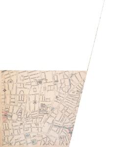
Insurance Plan of London Vol. xi: sheet 396
1 : 480 This detailed 1891 plan of London is one of a series of forty seven sheets in an atlas originally produced to aid insurance companies in assessing fire risks. The building footprints, their use (commercial, residential, educational, etc.), the number of floors and the height of the building, as well as construction materials (and thus risk of burning) and special fire hazards (chemicals, kilns, ovens) were documented in order to estimate premiums. Names of individual businesses, property lines, and addresses were also often recorded. Together these maps provide a rich historical shapshot of the commercial activity and urban landscape of towns and cities at the time. The British Library holds a comprehensive collection of fire insurance plans produced by the London-based firm Charles E. Goad Ltd. dating back to 1885. These plans were made for most important towns and cities of the British Isles at the scales of 1:480 (1 inch to 40 feet), as well as many foreign towns at 1:600 (1 inch to 50 feet). Chas E Goad Limited Chas E Goad Limited
Insurance Plan of London North District Vol. D: sheet 10
1 : 480 This detailed 1901 plan of London is one of a series of twenty sheets in an atlas originally produced to aid insurance companies in assessing fire risks. The building footprints, their use (commercial, residential, educational, etc.), the number of floors and the height of the building, as well as construction materials (and thus risk of burning) and special fire hazards (chemicals, kilns, ovens) were documented in order to estimate premiums. Names of individual businesses, property lines, and addresses were also often recorded. Together these maps provide a rich historical shapshot of the commercial activity and urban landscape of towns and cities at the time. The British Library holds a comprehensive collection of fire insurance plans produced by the London-based firm Charles E. Goad Ltd. dating back to 1885. These plans were made for most important towns and cities of the British Isles at the scales of 1:480 (1 inch to 40 feet), as well as many foreign towns at 1:600 (1 inch to 50 feet). Chas E Goad Limited Chas E Goad Limited
PLAN OF AN ESTATE AT ISLINGTON belonging to the CLOTHWORKERS COMPANY To be Let for Building.
1 : 804 The Clothworkers Company owned the land marked on this map. The Clothworkers were one of the City Livery Companies, many of which came to own property in London through the wealth generated by their trade. Angell, Samuel
Insurance Plan of London Vol. xi: sheet 394-1
1 : 480 This detailed 1891 plan of London is one of a series of forty seven sheets in an atlas originally produced to aid insurance companies in assessing fire risks. The building footprints, their use (commercial, residential, educational, etc.), the number of floors and the height of the building, as well as construction materials (and thus risk of burning) and special fire hazards (chemicals, kilns, ovens) were documented in order to estimate premiums. Names of individual businesses, property lines, and addresses were also often recorded. Together these maps provide a rich historical shapshot of the commercial activity and urban landscape of towns and cities at the time. The British Library holds a comprehensive collection of fire insurance plans produced by the London-based firm Charles E. Goad Ltd. dating back to 1885. These plans were made for most important towns and cities of the British Isles at the scales of 1:480 (1 inch to 40 feet), as well as many foreign towns at 1:600 (1 inch to 50 feet). Chas E Goad Limited Chas E Goad Limited
Insurance Plan of London North District Vol. D: sheet 11-1
1 : 480 This detailed 1901 plan of London is one of a series of twenty sheets in an atlas originally produced to aid insurance companies in assessing fire risks. The building footprints, their use (commercial, residential, educational, etc.), the number of floors and the height of the building, as well as construction materials (and thus risk of burning) and special fire hazards (chemicals, kilns, ovens) were documented in order to estimate premiums. Names of individual businesses, property lines, and addresses were also often recorded. Together these maps provide a rich historical shapshot of the commercial activity and urban landscape of towns and cities at the time. The British Library holds a comprehensive collection of fire insurance plans produced by the London-based firm Charles E. Goad Ltd. dating back to 1885. These plans were made for most important towns and cities of the British Isles at the scales of 1:480 (1 inch to 40 feet), as well as many foreign towns at 1:600 (1 inch to 50 feet). Chas E Goad Limited Chas E Goad Limited
Insurance Plan of London North District Vol. D: sheet 12
1 : 480 This detailed 1901 plan of London is one of a series of twenty sheets in an atlas originally produced to aid insurance companies in assessing fire risks. The building footprints, their use (commercial, residential, educational, etc.), the number of floors and the height of the building, as well as construction materials (and thus risk of burning) and special fire hazards (chemicals, kilns, ovens) were documented in order to estimate premiums. Names of individual businesses, property lines, and addresses were also often recorded. Together these maps provide a rich historical shapshot of the commercial activity and urban landscape of towns and cities at the time. The British Library holds a comprehensive collection of fire insurance plans produced by the London-based firm Charles E. Goad Ltd. dating back to 1885. These plans were made for most important towns and cities of the British Isles at the scales of 1:480 (1 inch to 40 feet), as well as many foreign towns at 1:600 (1 inch to 50 feet). Chas E Goad Limited Chas E Goad Limited
Insurance Plan of London North North West District Vol. D: sheet 21
1 : 480 This detailed 1892 plan of London is one of a series of eight sheets in an atlas originally produced to aid insurance companies in assessing fire risks. The building footprints, their use (commercial, residential, educational, etc.), the number of floors and the height of the building, as well as construction materials (and thus risk of burning) and special fire hazards (chemicals, kilns, ovens) were documented in order to estimate premiums. Names of individual businesses, property lines, and addresses were also often recorded. Together these maps provide a rich historical shapshot of the commercial activity and urban landscape of towns and cities at the time. The British Library holds a comprehensive collection of fire insurance plans produced by the London-based firm Charles E. Goad Ltd. dating back to 1885. These plans were made for most important towns and cities of the British Isles at the scales of 1:480 (1 inch to 40 feet), as well as many foreign towns at 1:600 (1 inch to 50 feet). Chas E Goad Limited Chas E Goad Limited
Insurance Plan of London North North West District Vol. D: sheet 20
1 : 480 This detailed 1892 plan of London is one of a series of eight sheets in an atlas originally produced to aid insurance companies in assessing fire risks. The building footprints, their use (commercial, residential, educational, etc.), the number of floors and the height of the building, as well as construction materials (and thus risk of burning) and special fire hazards (chemicals, kilns, ovens) were documented in order to estimate premiums. Names of individual businesses, property lines, and addresses were also often recorded. Together these maps provide a rich historical shapshot of the commercial activity and urban landscape of towns and cities at the time. The British Library holds a comprehensive collection of fire insurance plans produced by the London-based firm Charles E. Goad Ltd. dating back to 1885. These plans were made for most important towns and cities of the British Isles at the scales of 1:480 (1 inch to 40 feet), as well as many foreign towns at 1:600 (1 inch to 50 feet). Chas E Goad Limited Chas E Goad Limited
Insurance Plan of London Vol. xi: sheet 394-2
1 : 480 This detailed 1891 plan of London is one of a series of forty seven sheets in an atlas originally produced to aid insurance companies in assessing fire risks. The building footprints, their use (commercial, residential, educational, etc.), the number of floors and the height of the building, as well as construction materials (and thus risk of burning) and special fire hazards (chemicals, kilns, ovens) were documented in order to estimate premiums. Names of individual businesses, property lines, and addresses were also often recorded. Together these maps provide a rich historical shapshot of the commercial activity and urban landscape of towns and cities at the time. The British Library holds a comprehensive collection of fire insurance plans produced by the London-based firm Charles E. Goad Ltd. dating back to 1885. These plans were made for most important towns and cities of the British Isles at the scales of 1:480 (1 inch to 40 feet), as well as many foreign towns at 1:600 (1 inch to 50 feet). Chas E Goad Limited Chas E Goad Limited
PLAN OF A FREEHOLD ESTATE Situate at ISLINGTON County of Middlesex. For Sale by MESSRS. DRIVER 1845
This is a plan of property for sale in nine individual lots on Lower Road in Islington.
Plan of property in Upper Street, Islington
1 : 180 Plan of properties on Upper Street, Islington, showing gardens lay out is also shown and recording the names of owner and occupants.
Insurance Plan of London North District Vol. D: sheet 13-1
1 : 480 This detailed 1901 plan of London is one of a series of twenty sheets in an atlas originally produced to aid insurance companies in assessing fire risks. The building footprints, their use (commercial, residential, educational, etc.), the number of floors and the height of the building, as well as construction materials (and thus risk of burning) and special fire hazards (chemicals, kilns, ovens) were documented in order to estimate premiums. Names of individual businesses, property lines, and addresses were also often recorded. Together these maps provide a rich historical shapshot of the commercial activity and urban landscape of towns and cities at the time. The British Library holds a comprehensive collection of fire insurance plans produced by the London-based firm Charles E. Goad Ltd. dating back to 1885. These plans were made for most important towns and cities of the British Isles at the scales of 1:480 (1 inch to 40 feet), as well as many foreign towns at 1:600 (1 inch to 50 feet). Chas E Goad Limited Chas E Goad Limited
Insurance Plan of London North District Vol. D: sheet 11-2
1 : 480 This detailed 1901 plan of London is one of a series of twenty sheets in an atlas originally produced to aid insurance companies in assessing fire risks. The building footprints, their use (commercial, residential, educational, etc.), the number of floors and the height of the building, as well as construction materials (and thus risk of burning) and special fire hazards (chemicals, kilns, ovens) were documented in order to estimate premiums. Names of individual businesses, property lines, and addresses were also often recorded. Together these maps provide a rich historical shapshot of the commercial activity and urban landscape of towns and cities at the time. The British Library holds a comprehensive collection of fire insurance plans produced by the London-based firm Charles E. Goad Ltd. dating back to 1885. These plans were made for most important towns and cities of the British Isles at the scales of 1:480 (1 inch to 40 feet), as well as many foreign towns at 1:600 (1 inch to 50 feet). Chas E Goad Limited Chas E Goad Limited
Insurance Plan of London North District Vol. D: sheet 14
1 : 480 This detailed 1901 plan of London is one of a series of twenty sheets in an atlas originally produced to aid insurance companies in assessing fire risks. The building footprints, their use (commercial, residential, educational, etc.), the number of floors and the height of the building, as well as construction materials (and thus risk of burning) and special fire hazards (chemicals, kilns, ovens) were documented in order to estimate premiums. Names of individual businesses, property lines, and addresses were also often recorded. Together these maps provide a rich historical shapshot of the commercial activity and urban landscape of towns and cities at the time. The British Library holds a comprehensive collection of fire insurance plans produced by the London-based firm Charles E. Goad Ltd. dating back to 1885. These plans were made for most important towns and cities of the British Isles at the scales of 1:480 (1 inch to 40 feet), as well as many foreign towns at 1:600 (1 inch to 50 feet). Chas E Goad Limited Chas E Goad Limited
Insurance Plan of London Vol. xi: sheet 399-2
1 : 480 This detailed 1891 plan of London is one of a series of forty seven sheets in an atlas originally produced to aid insurance companies in assessing fire risks. The building footprints, their use (commercial, residential, educational, etc.), the number of floors and the height of the building, as well as construction materials (and thus risk of burning) and special fire hazards (chemicals, kilns, ovens) were documented in order to estimate premiums. Names of individual businesses, property lines, and addresses were also often recorded. Together these maps provide a rich historical shapshot of the commercial activity and urban landscape of towns and cities at the time. The British Library holds a comprehensive collection of fire insurance plans produced by the London-based firm Charles E. Goad Ltd. dating back to 1885. These plans were made for most important towns and cities of the British Isles at the scales of 1:480 (1 inch to 40 feet), as well as many foreign towns at 1:600 (1 inch to 50 feet). Chas E Goad Limited Chas E Goad Limited
Insurance Plan of London North District Vol. D: sheet 13-3
1 : 480 This detailed 1901 plan of London is one of a series of twenty sheets in an atlas originally produced to aid insurance companies in assessing fire risks. The building footprints, their use (commercial, residential, educational, etc.), the number of floors and the height of the building, as well as construction materials (and thus risk of burning) and special fire hazards (chemicals, kilns, ovens) were documented in order to estimate premiums. Names of individual businesses, property lines, and addresses were also often recorded. Together these maps provide a rich historical shapshot of the commercial activity and urban landscape of towns and cities at the time. The British Library holds a comprehensive collection of fire insurance plans produced by the London-based firm Charles E. Goad Ltd. dating back to 1885. These plans were made for most important towns and cities of the British Isles at the scales of 1:480 (1 inch to 40 feet), as well as many foreign towns at 1:600 (1 inch to 50 feet). Chas E Goad Limited Chas E Goad Limited
A New and Accurate SURVEY of the PARISHES of St. Andrews Holbourn
Plan of the parishes of St. Andrew's, Holborn, St George's, Queen Square, St James's Clerkenwell, St Luke's, Old Street, St Mary's Islington and the Charterhouse Liberty. Cole, B.
Insurance Plan of London North District Vol. D (Key C): sheet 3-1
1 : 480 This detailed 1901 plan of London is one of a series of twenty sheets in an atlas originally produced to aid insurance companies in assessing fire risks. The building footprints, their use (commercial, residential, educational, etc.), the number of floors and the height of the building, as well as construction materials (and thus risk of burning) and special fire hazards (chemicals, kilns, ovens) were documented in order to estimate premiums. Names of individual businesses, property lines, and addresses were also often recorded. Together these maps provide a rich historical shapshot of the commercial activity and urban landscape of towns and cities at the time. The British Library holds a comprehensive collection of fire insurance plans produced by the London-based firm Charles E. Goad Ltd. dating back to 1885. These plans were made for most important towns and cities of the British Isles at the scales of 1:480 (1 inch to 40 feet), as well as many foreign towns at 1:600 (1 inch to 50 feet). Chas E Goad Limited Chas E Goad Limited
London (1915- Numbered sheets) V.6 (includes: Finsbury; Holborn; Islington; St Pancras) - 25 Inch Map
1 : 2500 Topographic maps Ordnance Survey Ordnance Survey
London (First Editions c1850s) XXVI (includes: Finsbury; Holborn; Islington; St Pancras) - 25 Inch Map
1 : 2500 Topographic maps Ordnance Survey Ordnance Survey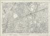
London (1915- Numbered sheets) V.2 (includes: Islington) - 25 Inch Map
1 : 2500 Topographic maps Ordnance Survey Ordnance Survey
London (Edition of 1894-96) XXXIX (includes: Islington) - 25 Inch Map
1 : 2500 Topographic maps Ordnance Survey Ordnance Survey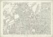
London (First Editions c1850s) XVII (includes: Islington) - 25 Inch Map
1 : 2500 Topographic maps Ordnance Survey Ordnance Survey