Maps of Küçükçekmece
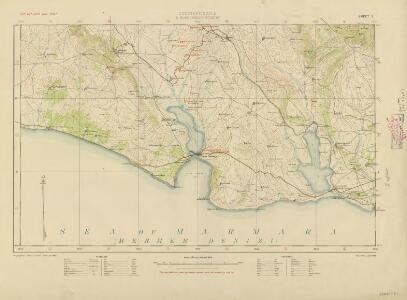
Constantinople & surrounding country, G.S.G.S. no 2390 (Sheet 3)
Constantinople & surrounding country, G.S.G.S. no 2390. Great Britain. War Office. General Staff. Geographical Section. [London] : Geographical Section, General Staff
Constantinople & surrounding country Scale, 1 : 63,360, etc
Sheet 3 of the four-sheet series, Constantinople & surrounding country. Scale, 1 : 63,360, etc. [London] : Geographical Section, General Staff
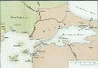
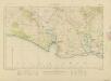
Istanbul 1:25,000, Series MDR 629
Istanbul 1:25,000, Series MDR 629. Great Britain. Army. Royal Engineers. Palestinian Field Survey Company,524th. [Cairo] : [Survey Directorate, Middle East]
Italien und Balkanhalbinsel. Nebenkarten II. 2. Konstantinopel und der Bosporus
Istanbul, Bosporus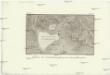
Plano de Constantinopla y sus inmediaciones
Istanbul (Turecko) Aguado, A. Vazques, J.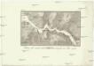
Plan del canal desde Constantinopla al mar Negro
Bospor (Turecko : průliv) Velazques, J. Vazques, J.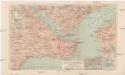
Konstantinopel
1 : 25000 Istanbul (Turecko) Bibliographisches Institut
Constantinopel und der Bosporus
1 : 100000 Bospor (Turecko : průliv) Kiepert, Heinrich Moltke, Helmuth von Simon Schropp'sche Hof-Landkarten-Handlg.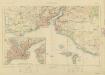
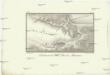
Constantinople & surrounding country, G.S.G.S. no 2390 (Sheet 1)
Constantinople & surrounding country, G.S.G.S. no 2390. Great Britain. War Office. General Staff. Geographical Section. [London] : Geographical Section, General Staff
Bosporus
1 : 500000 Bosporus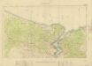
Constantinople & surrounding country, G.S.G.S. no 2390 (Sheet 2)
Constantinople & surrounding country, G.S.G.S. no 2390. Great Britain. War Office. General Staff. Geographical Section. [London] : Geographical Section, General Staff
Generalkarte von Zentraleuropa
Continuacion del mar de Mármara
Marmarské moře (Turecko) Velazques, J. Brieva, S.
Übersichtskarte
1 : 400000 Türkei Osmanisches Reich Balkankrieg <1912-1913> Mahmud, Muhtar Paşa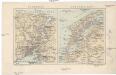
Bosporus, Dardanellen
Bospor (Turecko : průliv) F. A. Brouckaus' Geogr.-artist. Anstalt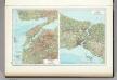
148. Dardanelles. Bosporus. The World Atlas.
1 : 500000 USSR (Union of Soviet Socialist Republics).
Charte von der Strasse der Dardanellen oder Hellespont und dem Canal Constantinopel (Bosporus) nebst dem Meer von Marmora mit den anliegenden Gegend von Europa und Asia
1 : 540000 Bospor (Turecko : průliv) Güssefeld, Franz L. Faden, W. A.G. Schneider u. Weigel
Charte von der Strasse der Dardanellen oder Hellespont und dem Canal von Constantinopel (Bosporus) nebst dem Meer von Marmora
1 Karte : Kupferdruck ; 36 x 61 cm, Bildgrösse 49 x 63 cm Güssefeld; Faden; Le Chevalier bey A.G. Schneider u. Weigel
Premières Possessions Territoriales
Nouvel atlas physique politique et historique de l'Empire ottoman et des états limitrophes en Europe, en Asie et en Afrique, en quarante feuilles Hellert, J.J. Bellizard, Dufour et Cie
Die Dardanellen in ihrer Lage zu Konstantinopel
Dardanellen
Konstantinopel, Šumla, Adrianopel, Dimotika
1 : 750000 Edirne (Turecko : oblast) Fendl. J. K. u. k. Militärgeographisches Institut
Constantinopel, Šumla, Adrianopel, Dimotika
1 : 750000 Edirne (Turecko : oblast) K. k. militär-geographisches Institut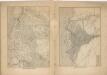
Kriegs Atlas 36 Karten von den Schauplätzen des Weltkrieges 1914/1915

Übersichtskarte von Mittel - Europa

Übersichtskarte von Mittel - Europa
A2. Constantinopel. / bearbeitet von Richard Kiepert. 1902-1916.
From 2nd Edition. 1: 400,000. 1908-1914.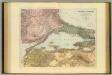
Sea of Marmara.
1 : 575300 Stanford, Edward
Ostthrakien
Ostthrakien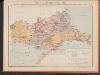
Carte des écoles et églises du vilayet d'Andrinople du sandjak de Tchataldja et de la partie européenne du vilayet de Constantinople (1908)
Türkei Vilâyet Edirne Ejalet Istanbul Sandschak Çatalca Kirchenbau Kümmerly & Frey