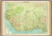
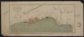
Maps of Northern Region

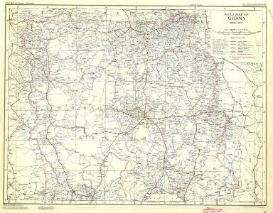
Ghana Road Map (North) 1957
Road map of Ghana, GSGS 4903. Later redesignated as Series G451. Great Britain. War Office. [London] : D. Survey, War Office & Air Ministry.
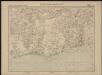
Carte des colonies de l'A.O.F. Tenkodogo
1 : 500000 Afrique occidentale française. Service géographique Paris : Blondel la Rougery
Carte des colonies de l'A.O.F. Bondoukou
1 : 500000 Afrique occidentale française. Service géographique Paris : Henry Barrère
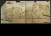
Map of Togo. A1. Sansane-Mangu

The Gold Coast with Togoland under British Mandate
Huppenbauer
Die Goldküste und Togo. Uebersichtskarte mit den Missionsstationen der Basler- und der Norddeutschen Missionsgesellschaft

Togo

Karte von Togo
1 : 200000 Togo Sprigade, Paul Mittler & Sohn
Skizze der topographischen Aufnahmen in der Umgebung von Bismarckburg durch Premierleutnant von Doering 1893 - 95

Die Goldküste und Togo.
Carte de l'Afrique occidentale française. Bingerville, Porto-Novo
1 : 2000000 France. Service géographique des colonies [Paris] : Service géographique des colonies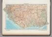
166. West Africa, South. The World Atlas.
1 : 3750000 USSR (Union of Soviet Socialist Republics).
Partie, la Guinee. Afrique 27.
1 : 1641836 Vandermaelen, Philippe, 1795-1869
Odumase und Aussenstationen
Carte des possessions anglaises et françaises sur le Golfe de Guinée
1 : 4600000 Paris : impr. de F. Menetrier
Mission du Commandant Decoeur entre le Dahomey et le Niger
1 : 100000 Decoeur [Paris] :
Mohamm. Händler auf der Goldküste

Die Missionen auf der Gold-Küste und Sklaven-Küste

östlicher Teil der Gold-KüsteBasler Missions-Gebiet

Carte du Haut-Dahomey
1 : 1180000 Chambre de commerce internationale. Comité de l'Afrique française [Paris] : Comité de l'Afrique française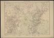
Carte de la Côte d'Ivoire dressée par A. Meunier. Kouadiokofi
1 : 500000 A. Meunier Paris : Service Géographique des Colonies
Carte de la boucle du Niger / dressée par Spicq ; Service Géographique des Colonies
1 : 1500000 Annotatie: Met Index alfabetique (76 p.) Henri Eugène Spicq; Service Géographique des Colonies Paris : Maison Andriveau-Goujon, Henri Barrère
The River Niger.
1 : 3400000 Arrowsmith, John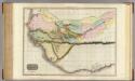
Western Africa.
1 : 3300000 Pinkerton, John, 1758-1826
West-Africa, Senegambien, Ober-Guinea.
1 : 6000000 Radefeld, Carl Christian Franz, 1788-1874
West Africa I.
1 : 5600000 Society for the Diffusion of Useful Knowledge (Great Britain)
Senegambien, Goldkuste, Kapland.
1 : 8000000 Andree, Richard
Equatorial West Africa [and] surroundings of Mount Cameroon
Cartes économiques de l'Afrique Occidentale Française. n5, élevage
1 : 3000000 Meunier, Alexandre, cartographe 18..-19.. Ministère des Colonies