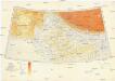
Maps of Varanasi

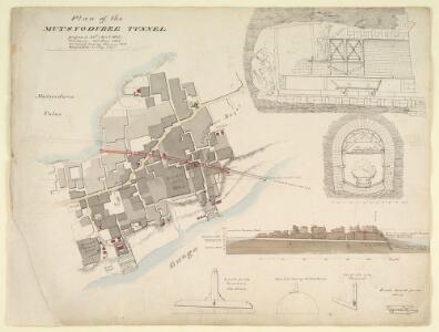
Map and cross section of the drainage tunnel from the Machhodri tank to the river, Benares, with elevation and cross section of the tunnelling process and drawings of the equipment used
Pen and ink and watercolour map and cross section of the drainage tunnel from the Machhodri tank to the river at Varanasi (Benares) in Uttar Pradesh by James Prinsep (1799-1840), dated c. 1825. This image shows the elevation and cross section of the tunnelling process and drawings of the equipment used and is inscribed: 'Plan of the Mutsyoduree Tunnel. Proposed 30th April 1825. Sanctioned 2nd June 1825. Commenced masonry 1826. Completed 31 July 1827'. On the reverse of the map is an unfinished diagram. Varanasi stands on the left bank of the Ganges and at its highest point stood well away from the river, but as the ground receded towards the water stagnant pools and marshes formed near the most densely inhabited areas during the rainy season and became a danger to health. Prinsep devised a plan to drain the city and built a network of drains and a tunnel which were considered a great feat of engineering. The Machhodri tank, drained by Prinsep, was formerly a marsh and later the site of a park and a grain market, the Bisheshwarganj, established in 1830. Prinsep came from a family who served in India for three generations; five of his brothers were also in the country. James, also a noted scholar and antiquarian, was Assistant Assay Master at the old Calcutta Mint in 1819, and after occupying the position at the Benares Mint from 1820-30 finally became Assay Master of the Calcutta Mint in 1832. Prinsep, James (1799-1840), Artist
Map of the area around the Machhodri tank, Benares, with cross sections showing relative water levels of the marsh and the river, and the site of the proposed drain. With notes and measurements
Pen and ink and watercolour map by James Prinsep (1799-1840) of the area around the Machhodri tank at Varanasi (Benares) in Uttar Pradesh, dated between 1822 and 1829. The map contains cross sections showing the relative water levels of the marsh and the river, and the site of the proposed drain, and includes notes and measurements. Varanasi stands on the left bank of the Ganges and at its highest point stood well away from the river, but as the ground receded towards the water stagnant pools and marshes formed near the most densely inhabited areas during the rainy season and became a danger to health. Prinsep devised a plan to drain the city and built a network of drains and a tunnel which were considered a great feat of engineering. The sewers were opened in 1824 and the tunnel, in 1827. The Machhodri tank, drained by Prinsep, was formerly a marsh and later the site of a park and a grain market, the Bisheshwarganj, established in 1830. Prinsep came from a family who served in India for three generations; five of his brothers were also in the country. James, also a noted scholar and antiquarian, was Assistant Assay Master at the old Calcutta Mint in 1819, and after occupying the position at the Benares Mint from 1820-30 finally became Assay Master of the Calcutta Mint in 1832. Prinsep, James (1799-1840), Artist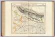
Nepaul. Asie 83.
1 : 1641836 Vandermaelen, Philippe, 1795-1869
India 7.
1 : 2217600 Letts, Son & Co.
India 10.
1 : 2217600 Letts, Son & Co.
India X.
1 : 2200000 Society for the Diffusion of Useful Knowledge (Great Britain)
India VII.
1 : 2200000 Society for the Diffusion of Useful Knowledge (Great Britain)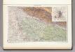
139. Upper Ganga (Ganges) Valley. Delhi. The World Atlas.
1 : 2500000 USSR (Union of Soviet Socialist Republics).
Composite: Delhi, Agrah, Oude, Ellahabad.
1 : 750000 Robert Laurie & James Whittle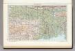
142. Lower Ganga (Ganges) Valley. The World Atlas.
1 : 2500000 USSR (Union of Soviet Socialist Republics).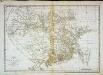
Carte du Bengale et de ses dépendances
1 Karte : Kupferdruck ; 37 x 53 cm Bolts s.n.
North-Western Provinces, Oudh, and Nepal.
1 : 3990000 W. & A.K. Johnston Limited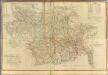
Composite: Bengal, Bahar &c.
1 : 750000 Robert Laurie & James Whittle
Provinces of the Lower Ganges.
1 : 2000000 John Bartholomew & Co.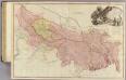
Bengal, Bahar, Oude, Allahabad.
1 : 1480000 Rennell, James, 1742-1830
Gangetic Hindoostan or the countries occupied by the Ganges and the branches
1 : 7000000 Cary, John, ca. 1754-1835 J. Cary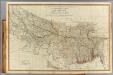
N. Hindostan.
1 : 1480000 Robert Laurie & James Whittle
Central division of Hindoostan
1 : 7000000 Cary, John, ca. 1754-1835 J. Cary
Sheet C [North East India], uit: Road map of India
1 : 2027520 titelvariant: North West India; Central & North India; North East India; South India; Annotatie geografische gegevens: De bladen overlappen elkaar gedeeltelijk; Elk blad met bladoverzicht van de hele serie [S.l. : India Tyre & Rubber Company]
Sheet B [Central & North India], uit: Road map of India
1 : 2027520 titelvariant: North West India; Central & North India; North East India; South India; Annotatie geografische gegevens: De bladen overlappen elkaar gedeeltelijk; Elk blad met bladoverzicht van de hele serie [S.l. : India Tyre & Rubber Company]

Map of the East Indian Railway
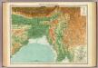
India - north-eastern section.
1 : 4000000 John Bartholomew & Co.
India - North. Pergamon World Atlas.
1 : 5000000 Polish Army Topography Service
India - north-western section.
1 : 4000000 John Bartholomew & Co.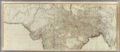
(Hindoostan north)
1 : 2500000 Robert Laurie & James Whittle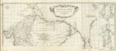
Carte de l'Inde. (Northern section).
1 : 3100000 Anville, Jean Baptiste Bourguignon d, 1697-1782
Northern India Including The Presidency of Calcutta.
1 : 9000000 Tallis, J. & F.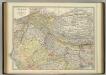
India (northern sheet).
1 : 4457000 Johnston, W. & A.K.