Maps of Tower Hamlets
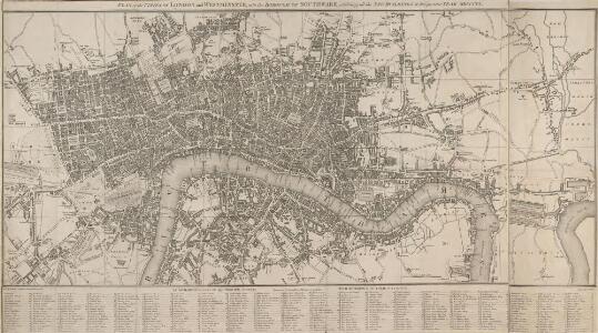
PLAN of the CITIES OF LONDON and WESTMINSTER, with the BOROUGH OF SOUTHWARK, exhibiting all the NEW BUILDINGS to the present YEAR MDCCCVI
As the 19th Century progressed, maps were often used as illustrations for general guides to London, for which there was a great demand. This map appeared in Lambert's 'History of London' of 1806. The title appears along the top with the reference table in a panel below the map. The plan extends eastward to include the East India Docks, opened in 1806. Lambert, B.
A NEW MAP OF LONDON with the adjacent Villages Including the New Streets and Public Buildings CORRECTED TO 1832
This map of London has an added sheet extending eastward to include the docks in the Isle of Dogs. The map is divided into rectangles, with letters and numbers along the borders for reference. The key to streets, public buildings and prominent places appears in a panel below the plan.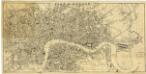
London[Plan of]. Drawn expressly for the Post Office
Wyld, J.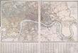
PLAN OF LONDON AND WESTMINSTER with the Borough of SOUTHWARK Being an INDEX to the Large Plan in forty Sheets
This folding map of London was originally published by Faden in 1818 as an index to Harwood's famous map of Regency London. This is a later edition of the map, issued by Wyld when he took over Faden's publishing business. The title, explanation and scale bar feature at top right. The boundaries of London, Westminster, Southwark, Lambeth, Marylebone, Finsbury and Tower Hamlets are outlined in colour. The map is divided into squares with letters and numbers for reference along the margins for reference, with an interpretive key in panel below the plan. Faden, William
LONDON AND WESTMINSTER with the Borough of SOUTHWARK Being an INDEX to the Large Plan in forty sheets 219
This folding map of London was originally published as the index to Harwood's famous map of Regency London. The map features the title, imprint and scale bar at the top right and is divided into squares, with letters and numbers along the borders for reference. Faden, William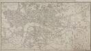
MAP of LONDON and its ENVIRONS 209
This later edition of Sherwood, Neely and Jones's 1813 original. The title appears along the top, with the publisher’s imprint and scale bar below the plan. The map shows Regents Park and the proposed new bridges at Vauxhall and Waterloo, with the Isle of Dogs and the East and West India Docks on an added sheet. Sherwood, Neely & Jones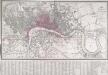
LONDON AND WESTMINSTER with the Borough of SOUTHWARK Being an INDEX to the Large Plan in forty sheets 231
The title, explanatory notesand scale bar of this folding mapappear at top right. The map is divided into squares, with letters and numbers for referencealong the margins. A key appears in a panel below the plan. Originally published by Faden in 1818 as an index to Harwood's famous map of Regency London,the map was reissued by James Wyld when he took over Faden's publishing business in the late 1820s. Faden, William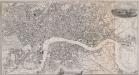
PAYNE'S ILLUSTRATED PLAN OF LONDON
Map of London with title inset in top border, general view of London at top right and view of the House of Parliament at bottom centre. The plan shows Hungerford suspension bridge, with the proposed Waterloo Bridge indicated by a pecked line. Payne, Albert Henry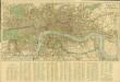
Reynolds’s Map of London with the latest improvements
Reynolds, James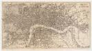
Reynolds's map of London : with the latest improvements
1 : 16000 Martin, Henry, fl. 1830-1852 J. Reynolds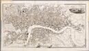
[Kaart], uit: Payne's illustrated plan of London
1 : 15000 Annotatie: Met een gezicht op Londen en een gezicht op het parlementsgebouw Payne, A. H. Dresden [etc.] : A.H. Payne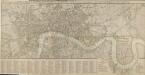
ROWE'S PLAN OF LONDON, WESTMINSTER and SOUTHWARK, exhibiting the various IMPROVEMENTS, to the Year 1804 with the LONDON and WEST INDIA DOCKS
The title of this map appears along the top, with the table of reference in a panel below the plan and scale bar at bottom right. The map is divided into rectangles for reference and shows the newly built London and West India Docks on the Isle of Dogs. Designed by William Jessop, the docks were completed in 1802 allowing West India Company merchants to discharge their ships in four days instead of the usual four weeks. Rowe, Robert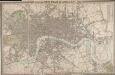
CROSS'S NEW PLAN OF LONDON 1828
The title of this folding map is inset in the top border, with the publisher's imprint and explanatory notes in the bottom border and a list of parishes in a table at top right. The map is divided into half-mile squares for reference, with the river, open spaces and the boundaries of London, Westminster and Southwark highlighted in different colours. Cross, Joseph
LONDON 269
This map of Victorian London was produced for publication in the Post Office Directory of 1852. The map's title and imprint appear at top right. It shows the entire London railway system. With the exception of Blackfriars and Marylebone stations, all London termini were built in the between 1736and 1876. As the railway companies scrambled to buy land to redevelop central London, many people, mainly slum-dwellers, were left homeless or forced to move to outer suburbs like Tottenham and Edmonton. Davies, Benjamin Rees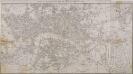
MAP of LONDON and its ENVIRONS 203
The title of this map appears along the top, with scale bar and imprint below the plan. It shows Regents Park and the proposed new bridges at Vauxhall and Waterloo, with the East and West India Docks in the Isle of Dogs added on a separate sheet. Sherwood, Neely & Jones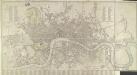
CARY'S New and Accurate Plan of LONDON AND WESTMINSTER, the Borough of SOUTHWARK and parts adjacent 210
This title of this folding map of London appears along the top. Open spaces are depicted in colour with a reference table in a panel below the plan. This is the twelfth edition of the map first issued by Cary in 1787, updated to include several new works of the Regency period. An added sheet extends eastward to include the Isle of Dogs and the East and West India Docks. Cary, John
LONDON 1849 DRAWN & ENGRAVED EXPRESSLY FOR THE POST OFFICE DIRECTORY
This map has been engraved for the Post Office Directory. It is the third edition of a map originally published in 1847. Davis, Benjamin Rees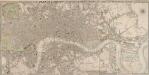
CRUCHLEY'S NEW PLAN OF LONDON IMPROVED TO 1826 INCLUDING THE EAST AND WEST INDIA DOCKS 223
The title of this folding map of London is inset in top border, with the publisher’s imprint and key to symbols in bottom border, scale bar near bottom right, and compass rose at top right. The river and open spaces are highlighted in colour. The map extends eastward on an added sheet to include the East and West India Docks. Cruchley, who first published the map in 1826, added the proposed Collier Docks in the Isle of Dogs to this later edition. The docks were never built and Millwall Docks now occupy part of the site Cruchley, George Frederick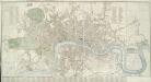
CARY'S New and Accurate Plan of LONDON AND WESTMINSTER, the Borough of SOUTHWARK and parts adjacent 221
The title of this folding map of London runs along the top, with a list of public buildings at top left, facing a list of churches at top right. Open spaces and the city boundaries are drawn in colour, withal reference table in the panel below the plan. John Cary, who first published this map in 1787, added a sheet to this later edition to include the Lea River, the Isle of Dogs and the new docks. The map also shows the Asylum for the Blind in St. George's Fields and the Penitentiary at Millbank. Cary, John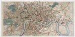
Post office plan of London
Wyld, James, 1812-1887 Ja.s Wyld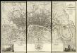
Map of London from an Actual Survey
Map of London printed in six sheets from a survey made during the period 1824-26.The map featurestitle and imprint at top right, dedication to King George IV at bottom centre, view of Westminster Abbeywith key to symbols at bottom left and view of St Paul's Cathedral with key to lines at bottom right. Greenwood, Christopher and John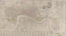
LONDON AND WESTMINSTER
The title of this map appears near the top right in a vignette depicting Father Thames, with compass rose at bottom right, scale bar at bottom centre, and an alphabetical list of streets in the table below the plan. Roads, open spaces and the built-up area within the city are depicted in colour. The boundaries of the 'Liberty’ of the Tower of London is similarly depicted in colour ('Liberty', in this sense, means an area of separate jurisdiction to the rest of the city). Finally, the map extends eastward to include the Isle of Dogs and the docks, which were then under construction. Fairburn, John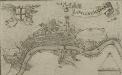
LONDINUM, LONDON
This small map possibly derives from a German work published in Nuremberg.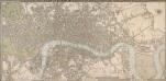
CRUCHLEY'S NEW PLAN OF LONDON IMPROVED TO 1826 INCLUDING THE EAST AND WEST INDIA DOCKS 226
The title of this folding map of London appears inset in the top border, with the publisher’s imprint and key to symbols in the bottom border, the scale bar near the bottom right, and a compass rose at the top right. The river and open spaces are distinguished in colour. The map extends eastward on an added sheet to include the Isle of Dogs and the East and West India Docks. Cruchley, George Frederick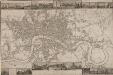
LANGLEY & BELCHE'S NEW MAP OF LONDON
Proof before letters is the term for an impression of a print withdrawn before the title is added to the image prior to publication. This is a proof before letters copy of Langley & Belche's 1812, with illustrated views of prominent London buildings (including the newly opened docks) along the top and bottom of the plate. The plan is divided into lettered squares for reference. It was originally accompanied by Langley & Belch's street directory or 'Companion to their new map of London'. Langley, Edward & Belch, William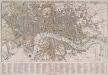
TEGG'S NEW PLAN OF LONDON, &c. WITH 360 REFERENCES TO THE PRINCIPAL STREETS &c.
The title of this folding map of London appears along the top. The city boundaries, open spaces, roads and watercourses are depicted in colour in colour. This is a later edition of a map first issued by Tegg in 1823. It is divided into rectangles for reference, with a street index in panel below the plan. Tegg, Thomas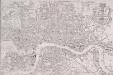
PAYNE'S IMPROVED PLAN OF LONDON
The title of this map appears at top right alongside the publisher’s imprint (in shield) and the city arms. The map is divided in half-mile squares with letters and numbers for reference running along the borders. It shows the Dover, Croydon, Greenwich, Blackwall, Eastern, North London, Great Northern and Birmingham railway lines and their termini. Payne, Albert Henry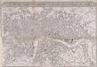
IMPROVED MAP OF LONDON for 1834, from AN ACTUAL SURVEY
The title of this map appears in a panel above the plan, with a scale bar inset in the bottom border. The map extends westward to include Chelsea Beach and shows the proposed tunnel under the Thames at Wapping. The Greenwich-to-London railway line also features. Under construction at the time of this survey, the line reached Bermondsey from Greenwich in 1836. Ten months later the line reached London Bridge, making it the first railway terminus in the capital.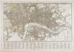
Tegg's new plan of London, &c.
T. Tegg