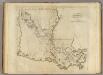
Maps of Louisiana
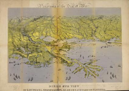
Panorama of the Seat of War. Bird's-eye View of Louisiana, Mississippi, Alabama and part of Florida. Drawn from nature by J. Bachmann.
Panorama of the Seat of War. Bird's-eye View of Louisiana, Mississippi, Alabama and part of Florida. Drawn from nature by J. Bachmann. This 1861 map presents a ‘Bird’s Eye View’ of the Gulf region around Louisiana, Mississippi, Alabama and the edge of Florida. Drawn and published by John Bachmann, the map details numerous strategic forts around this region, including Forts Pickens, Phillip and Jackson, as well as the city of New Orleans. The map highlights how important water routes and control of coastal defences were by both sides during the conflict.
E. United States 9.
1 : 1774080 Letts, Son & Co.
Louisiana.
from Carey's general atlas, improved and enlarged : being a collection of maps of the world and quarters, their principal empires, kingdoms, &c.
Map of Louisiana, Mississippi and Alabama.
1 : 1700000 Mitchell, Samuel Augustus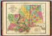
Map of Louisiana Mississippi And Alabama.
1 : 1750000 Finley, Anthony
Pts. of Louisiana, Ark., Miss., Ala., Florida.
1 : 1770000 Society for the Diffusion of Useful Knowledge (Great Britain)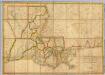
A Map of the State of Louisiana.
1 : 633600 Melish, John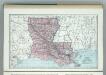
Louisiana.
1 : 1788000 Hammond, C.S.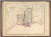
States Of Mississippi And Louisiana.
1 : 3453120 Rogers, Henry Darwin
Mississippi, Alabama, Florida, Georgia.
1 : 1584000 Smith, J. Calvin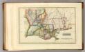
Louisiana.
1 : 1970000 Lucas, Fielding Jr.
Louisiana.
1 : 2000000 Tanner, Henry S.
Louisiana.
1 : 2400000 Lucas, Fielding Jr.
Louisiana.
1 : 1520000 Mitchell, Samuel Augustus
Louisiana.
1 : 1520000 Mitchell, Samuel Augustus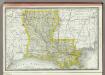
Louisiana.
1 : 1460000 Rand McNally and Company
Special -Karte der Vereinigten Staaten von Nord - America No 14.

Neueste Karte von Louisiana mit seinen Canaelen, Strassen, Eisenbahnen, Entfernungen der Hauptpunkte und Routen für Dampfschiffe
Grosser Hand-Atlas über alle Theile der Erde in 170 Karten Meyer, J. Verlag des Bibliographischen Instituts
Schonberg's Map of Louisiana.
1 : 1900000 Schonberg & Co.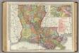
Louisiana.
1 : 950000 Rand McNally and Company
Louisiana.
Rand McNally and Company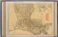
Louisiana.
1 : 1014000 Rand McNally and Company
Louisiana.
1 : 2350000 Finley, Anthony
Louisiana.
1 : 1609000 Colton, G. Woolworth
Louisiana.
1 : 1500000 Colton, G.W.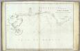
The coasts of West Florida, Alabama, Mississippi & Louisiana.
1 : 680000 Gauld, George.
Louisiana.
1 : 1500000 Colton, G.W.
Louisiana.
1 : 1500000 Colton, G.W.
Louisiana.
1 : 980000 Rand McNally and Company
State of Louisiana.
1 : 887040 U.S. General Land Office
Louisiana.
1 : 2100000 Rand McNally and Company
Louisiana.
1 : 1330560 Cram Atlas Company
Louisiana.
1 : 1140480 U.S. General Land Office
Louisiana.
1 : 1647360 Colton, G.W.
Louisiana.
1 : 1750000 Greenleaf, Jeremiah
New Map Of Louisiana.
1 : 1900800 Mitchell, Samuel Augustus
New Map Of Louisiana.
1 : 2050000 Tanner, Henry S.
Louisiana.
1 : 1700000 Morse, Sidney E. (Sidney Edwards), 1794-1871
Louisiana.
1 : 2050000 Meyer, Joseph, 1796-1856
Louisiana.
1 : 1700000 Goodrich, S.G.
Louisiana.
1 : 1730000 Greenleaf, Jeremiah
Louisiana.
1 : 1700000 Bradford, Thomas G.
New Map Of Louisiana.
1 : 2050000 Tanner, Henry S.
Louisiana.
1 : 1774080 Burr, David H., 1803-1875
Louisiana.
1 : 2350000 Finley, Anthony
Louisiana.
1 : 1964160 Lucas, Fielding Jr.
Map Of Louisiana.
1 : 1837440 Lea, I.
Louisiana.
1 : 1260000 Carey, Mathew