Maps of Baltimore County
Map of the Seat of War: Washington, Baltimore, Harper's Ferry and Annapolis
Map of the Seat of War: Washington, Baltimore, Harper's Ferry and Annapolis L. Prang & Co.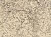
Strategic War Points of the United States no.1: Country Road Washington
Strategic War points of the United States: Country Road Washingon J. Wyld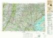
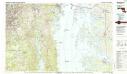
Baltimore
1 : 250000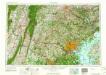
Baltimore
1 : 250000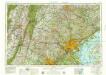
Baltimore
1 : 250000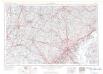
Baltimore
1 : 250000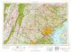
Baltimore
1 : 250000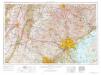
Baltimore
1 : 250000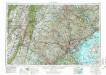
Baltimore
1 : 250000
Baltimore
1 : 250000
Baltimore
1 : 250000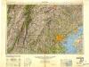
Baltimore
1 : 250000
Baltimore
1 : 250000
Army Map Of The Seat Of War In Virginia.
1 : 190000 Disturnell, John
E. & G.W. Blunt's corrected map of Washington and the seat of war on the Potomac
1 : 402500 E. & G.W. Blunt (Firm) E. & G.W. Blunt (Firm)
Map of the Battle Ground, showing 5 mile distances from Washington
Map of the Battle Ground, showing 5 mile distances from Washington L. Prang & Co.
Composite: Staten Island.
1 : 253440 Dripps, Matthew
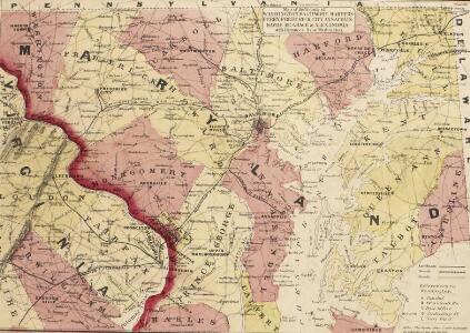
Baltimore.
1 : 221760 Martenet, Simon J.
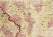
Montgomery.
1 : 221760 Martenet, Simon J.
Prince George's.
1 : 221760 Martenet, Simon J.
The harbor of Annapolis / founded upon a trigonometrical survey under the direction of A.D. Bache, superintendent of the Survey of the Coast of the United States ; triangulation by James Ferguson and Ferd. H. Gerdes, assistants ; the hydrography under th
from Maryland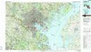
Baltimore
1 : 100000
Baltimore, Annapolis, and adjacent country.
from A geographical description of the United States, with the contiguous British and Spanish possessions : intended as an accompaniment to Melish's map of these countries / by John Melish.
Topographical atlas of Maryland: counties of Howard and Montgomery and D.C.
1 : 221760 Walling, H. F.
Topographical atlas of Maryland: counties of Caroline, Queen Anne and Talbot.
1 : 221760 Walling, H. F.
Topographical atlas of Maryland: counties of Carroll and Frederick.
1 : 221760 Walling, H. F.
Topographical atlas of Maryland: counties of Baltimore and Harford.
1 : 221760 Walling, H. F.
Anne Arundel.
1 : 221760 Martenet, Simon J.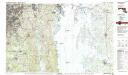
Washington East
1 : 100000