Maps of Kewstoke

Wick St. Lawrence
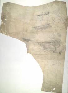
This drawing covers the area around the mouth of the River Severn, showing sandbanks and the confluence of the River Yeo. Much of the surrounding land is flat with field boundaries marked clearly on the plan. Around Bleadon Hill, red lines descripe fields with stone walls. To the right of Newton, a castle is marked by a white circle. The drawing is covered by three-inch squares used for copying and reduction.
ST26 - OS 1:25,000 Provisional Series Map
1 : 25000 Topographic maps Ordnance Survey Ordnance Survey
ST35 & Parts of ST25 - OS 1:25,000 Provisional Series Map
1 : 25000 Topographic maps Ordnance Survey Ordnance Survey
Somerset XVI.NW - OS Six-Inch Map
1 : 10560 Topographic maps Ordnance Survey Ordnance Survey
Somerset XVI.NW - OS Six-Inch Map
1 : 10560 Topographic maps Ordnance Survey Ordnance Survey
Somerset XVI.SW - OS Six-Inch Map
1 : 10560 Topographic maps Ordnance Survey Ordnance Survey
Somerset XVI.SW - OS Six-Inch Map
1 : 10560 Topographic maps Ordnance Survey Ordnance Survey
Somerset IX.NE - OS Six-Inch Map
1 : 10560 Topographic maps Ordnance Survey Ordnance Survey
Somerset IX.NE - OS Six-Inch Map
1 : 10560 Topographic maps Ordnance Survey Ordnance Survey
Somerset IX.NE - OS Six-Inch Map
1 : 10560 Topographic maps Ordnance Survey Ordnance Survey
Somerset XXV.NW - OS Six-Inch Map
1 : 10560 Topographic maps Ordnance Survey Ordnance Survey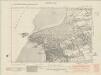
Somerset IX.SE - OS Six-Inch Map
1 : 10560 Topographic maps Ordnance Survey Ordnance Survey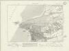
Somerset IX.SE - OS Six-Inch Map
1 : 10560 Topographic maps Ordnance Survey Ordnance Survey
Somerset IX.SE - OS Six-Inch Map
1 : 10560 Topographic maps Ordnance Survey Ordnance Survey
Somerset IX.SE - OS Six-Inch Map
1 : 10560 Topographic maps Ordnance Survey Ordnance Survey
Somerset XVI.NE - OS Six-Inch Map
1 : 10560 Topographic maps Ordnance Survey Ordnance Survey
Somerset XVI.NE - OS Six-Inch Map
1 : 10560 Topographic maps Ordnance Survey Ordnance Survey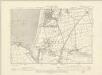
Somerset XVI.NE - OS Six-Inch Map
1 : 10560 Topographic maps Ordnance Survey Ordnance Survey
Somerset XVI.NE - OS Six-Inch Map
1 : 10560 Topographic maps Ordnance Survey Ordnance Survey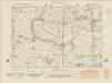
Somerset XVI.SE - OS Six-Inch Map
1 : 10560 Topographic maps Ordnance Survey Ordnance Survey
Somerset XVI.SE - OS Six-Inch Map
1 : 10560 Topographic maps Ordnance Survey Ordnance Survey
Somerset XVI.SE - OS Six-Inch Map
1 : 10560 Topographic maps Ordnance Survey Ordnance Survey
Somerset XXV.NE - OS Six-Inch Map
1 : 10560 Topographic maps Ordnance Survey Ordnance Survey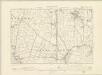
Somerset XXV.NE - OS Six-Inch Map
1 : 10560 Topographic maps Ordnance Survey Ordnance Survey
Somerset XXV.NE - OS Six-Inch Map
1 : 10560 Topographic maps Ordnance Survey Ordnance Survey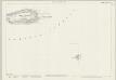
Somerset XV.4 & 3 (includes: Steep Holme Island) - 25 Inch Map
1 : 2500 Topographic maps Ordnance Survey Ordnance Survey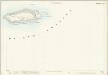
Somerset XV.4 & 3 (includes: Steep Holme Island) - 25 Inch Map
1 : 2500 Topographic maps Ordnance Survey Ordnance Survey
Somerset XXIV.8 (includes: Berrow) - 25 Inch Map
1 : 2500 Topographic maps Ordnance Survey Ordnance Survey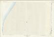
Somerset XVI.9 & 10 (includes: Brean) - 25 Inch Map
1 : 2500 Topographic maps Ordnance Survey Ordnance Survey