Maps of Staffordshire

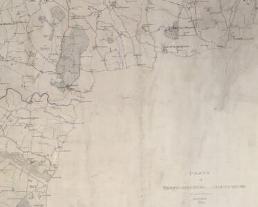
Detail from OSD,334 (Sudbury Park), showing Sudbury Hall
1 : 31680 A detail from OSD Map 334, showing Sudbury Hall in Derbyshire, surveyed in 1832-33. The county boundary,of Derbyshire and Staffordshire is indicated by a red pecked line. The boundary closely follows the River Dove, to the south of Sudbury Hall. No indications of relief are given, suggesting that this is an outline plan,,the midpoint,between the original protraction and the finished drawing. The road network is precisely delineated. Major communication routes are coloured yellow, following military cartographic convention. Stephens, Henry
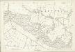
Derbyshire LIII - OS Six-Inch Map
1 : 10560 Topographic maps Ordnance Survey Ordnance Survey
Derbyshire LIII.NW - OS Six-Inch Map
1 : 10560 Topographic maps Ordnance Survey Ordnance Survey
Derbyshire LIII.NW - OS Six-Inch Map
1 : 10560 Topographic maps Ordnance Survey Ordnance Survey
Derbyshire LIII.SW - OS Six-Inch Map
1 : 10560 Topographic maps Ordnance Survey Ordnance Survey
Staffordshire XXXIII.SW - OS Six-Inch Map
1 : 10560 Topographic maps Ordnance Survey Ordnance Survey
Derbyshire LIII.NE - OS Six-Inch Map
1 : 10560 Topographic maps Ordnance Survey Ordnance Survey
Derbyshire LIII.NE - OS Six-Inch Map
1 : 10560 Topographic maps Ordnance Survey Ordnance Survey
Derbyshire LIII.SE - OS Six-Inch Map
1 : 10560 Topographic maps Ordnance Survey Ordnance Survey
Derbyshire LIII.SE - OS Six-Inch Map
1 : 10560 Topographic maps Ordnance Survey Ordnance Survey
Derbyshire XLVIII.SW - OS Six-Inch Map
1 : 10560 Topographic maps Ordnance Survey Ordnance Survey
Derbyshire XLVIII.SW - OS Six-Inch Map
1 : 10560 Topographic maps Ordnance Survey Ordnance Survey
Derbyshire XLVIII.SE - OS Six-Inch Map
1 : 10560 Topographic maps Ordnance Survey Ordnance Survey
Derbyshire XLVIII.SE - OS Six-Inch Map
1 : 10560 Topographic maps Ordnance Survey Ordnance Survey
Derbyshire XLVII.16 (includes: Doveridge; Somersal Herbert; Sudbury) - 25 Inch Map
1 : 2500 Topographic maps Ordnance Survey Ordnance Survey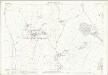
Derbyshire XLVII.16 (includes: Doveridge; Somersal Herbert; Sudbury) - 25 Inch Map
1 : 2500 Topographic maps Ordnance Survey Ordnance Survey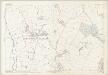
Derbyshire XLVII.16 (includes: Doveridge; Somersal Herbert; Sudbury) - 25 Inch Map
1 : 2500 Topographic maps Ordnance Survey Ordnance Survey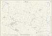
Derbyshire LII.4 (includes: Doveridge; Somersal Herbert; Sudbury) - 25 Inch Map
1 : 2500 Topographic maps Ordnance Survey Ordnance Survey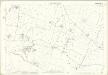
Derbyshire LII.4 (includes: Doveridge; Somersal Herbert; Sudbury) - 25 Inch Map
1 : 2500 Topographic maps Ordnance Survey Ordnance Survey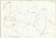
Derbyshire LII.4 (includes: Doveridge; Somersal Herbert; Sudbury) - 25 Inch Map
1 : 2500 Topographic maps Ordnance Survey Ordnance Survey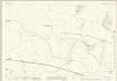
Derbyshire LII.8 (includes: Doveridge; Marchington; Sudbury) - 25 Inch Map
1 : 2500 Topographic maps Ordnance Survey Ordnance Survey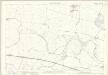
Derbyshire LII.8 (includes: Doveridge; Marchington; Sudbury) - 25 Inch Map
1 : 2500 Topographic maps Ordnance Survey Ordnance Survey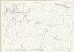
Staffordshire XXXII.12 (includes: Draycott In The Clay; Marchington) - 25 Inch Map
1 : 2500 Topographic maps Ordnance Survey Ordnance Survey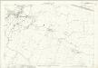
Staffordshire XXXII.12 (includes: Draycott In The Clay; Marchington) - 25 Inch Map
1 : 2500 Topographic maps Ordnance Survey Ordnance Survey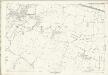
Staffordshire XXXII.12 (includes: Draycott In The Clay; Marchington) - 25 Inch Map
1 : 2500 Topographic maps Ordnance Survey Ordnance Survey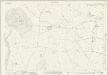
Derbyshire XLVIII.13 (includes: Boyleston; Church Broughton; Cubley; Sudbury) - 25 Inch Map
1 : 2500 Topographic maps Ordnance Survey Ordnance Survey
Derbyshire XLVIII.13 (includes: Boyleston; Church Broughton; Cubley; Sudbury) - 25 Inch Map
1 : 2500 Topographic maps Ordnance Survey Ordnance Survey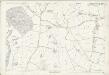
Derbyshire XLVIII.13 (includes: Boyleston; Church Broughton; Cubley; Sudbury) - 25 Inch Map
1 : 2500 Topographic maps Ordnance Survey Ordnance Survey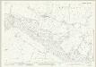
Staffordshire XXXII.16 (includes: Draycott In The Clay; Hanbury; Marchington; Newborough) - 25 Inch Map
1 : 2500 Topographic maps Ordnance Survey Ordnance Survey
Staffordshire XXXII.16 (includes: Draycott In The Clay; Hanbury; Marchington; Newborough) - 25 Inch Map
1 : 2500 Topographic maps Ordnance Survey Ordnance Survey