Maps of Rushden
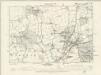
Buntingford
1 : 31680 Heavy brushwork interlining ('hachuring') depicting relief gives this map a three-dimensional quality. This elaborate hill shading and the attention given to communications routes conform to the military and cartographic standards employed by the Ordnance Survey. Buildings are infilled and blocked together in carmine at larger settlements, such as the historic town of Braughing towards the bottom of the plan. Braughing was strategically important due to its close proximity to three ancient roads: Icknield Way, Ermine Street and Stane Street. These roads were important for trade and communication. The dashed black-ink line which runs towards East End from the top-centre of the plan marks the boundary between Essex and Hertfordshire.
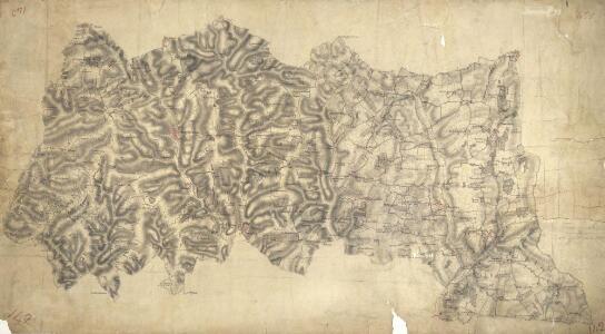
A topographical map of Hartford-Shire, 6
1 Blatt : 53 x 72 cm A. Dury
TL32 - OS 1:25,000 Provisional Series Map
1 : 25000 Topographic maps Ordnance Survey Ordnance Survey
TL42 - OS 1:25,000 Provisional Series Map
1 : 25000 Topographic maps Ordnance Survey Ordnance Survey
Essex XIII - OS Six-Inch Map
1 : 10560 Topographic maps Ordnance Survey Ordnance Survey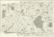
Essex XXII - OS Six-Inch Map
1 : 10560 Topographic maps Ordnance Survey Ordnance Survey
Essex nXXIII - OS Six-Inch Map
1 : 10560 Topographic maps Ordnance Survey Ordnance Survey
Essex nXXIII - OS Six-Inch Map
1 : 10560 Topographic maps Ordnance Survey Ordnance Survey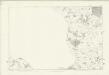
Hertfordshire XV - OS Six-Inch Map
1 : 10560 Topographic maps Ordnance Survey Ordnance Survey
Essex nXXII - OS Six-Inch Map
1 : 10560 Topographic maps Ordnance Survey Ordnance Survey
Hertfordshire XIV - OS Six-Inch Map
1 : 10560 Topographic maps Ordnance Survey Ordnance Survey
Essex nXIII - OS Six-Inch Map
1 : 10560 Topographic maps Ordnance Survey Ordnance Survey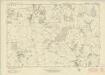
Essex nXII - OS Six-Inch Map
1 : 10560 Topographic maps Ordnance Survey Ordnance Survey
Essex nXII - OS Six-Inch Map
1 : 10560 Topographic maps Ordnance Survey Ordnance Survey
Hertfordshire IX - OS Six-Inch Map
1 : 10560 Topographic maps Ordnance Survey Ordnance Survey
Hertfordshire XIII - OS Six-Inch Map
1 : 10560 Topographic maps Ordnance Survey Ordnance Survey
TL43 - OS 1:25,000 Provisional Series Map
1 : 25000 Topographic maps Ordnance Survey Ordnance Survey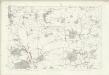
Hertfordshire VIII - OS Six-Inch Map
1 : 10560 Topographic maps Ordnance Survey Ordnance Survey
TL33 - OS 1:25,000 Provisional Series Map
1 : 25000 Topographic maps Ordnance Survey Ordnance Survey
TL52 - OS 1:25,000 Provisional Series Map
1 : 25000 Topographic maps Ordnance Survey Ordnance Survey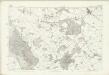
Hertfordshire XXII - OS Six-Inch Map
1 : 10560 Topographic maps Ordnance Survey Ordnance Survey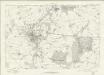
Essex nXXXII - OS Six-Inch Map
1 : 10560 Topographic maps Ordnance Survey Ordnance Survey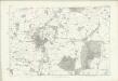
Hertfordshire XXIII - OS Six-Inch Map
1 : 10560 Topographic maps Ordnance Survey Ordnance Survey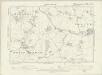
Essex XIII.NW - OS Six-Inch Map
1 : 10560 Topographic maps Ordnance Survey Ordnance Survey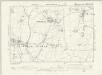
Essex XIII.SW - OS Six-Inch Map
1 : 10560 Topographic maps Ordnance Survey Ordnance Survey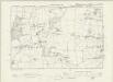
Essex XXII.NW - OS Six-Inch Map
1 : 10560 Topographic maps Ordnance Survey Ordnance Survey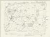
Essex XXII.SW - OS Six-Inch Map
1 : 10560 Topographic maps Ordnance Survey Ordnance Survey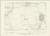
Essex XIII.NE - OS Six-Inch Map
1 : 10560 Topographic maps Ordnance Survey Ordnance Survey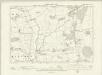
Essex XIII.SE - OS Six-Inch Map
1 : 10560 Topographic maps Ordnance Survey Ordnance Survey