Maps of Great Plains
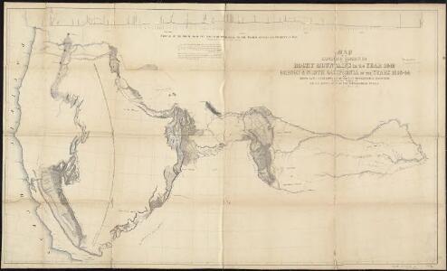
Map of an exploring expedition to the Rocky Mountains in the year 1842 and to Oregon & north California in the years 1843-44
1 : 2000000 Frémont, John Charles United States. Congress. Senate
California and the Western Territories.
1 : 8100000 Schonberg & Co.
Western States.
1 : 5000000 Black, Adam & Charles
Etats Unis. Flle. N.O.
1 : 5000000 Vivien St Martin, L.
United States of North America (North West Sheet).
1 : 3984000 Johnston, W. & A.K.
Map of Oregon, California, New Mexico, N.W. Texas & ... Ne-Bras-Ka.
1 : 4600000 Sage, Rufus B.
Oregon, Californien, Utah, New Mexico, etc.
1 : 10800000 Lange, Henry, 1821-1893.
209-210. United States of America, West. The World Atlas.
1 : 5000000 USSR (Union of Soviet Socialist Republics).
Skeleton Map Of the Territory of the United States west of the Mississippi River.
1 : 6000000 Wheeler, G.M.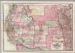
Colton's Map Of The States And Territories West Of The Mississippi River.
1 : 3105000 Colton, J. H.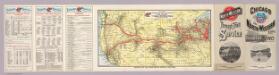
Through train service from Chicago.
1 : 9676800 Chicago and North Western Railway Company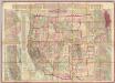
Watson's New County and Railroad Map of the Western States and Territories.
1 : 2534400 Watson, Gaylord
Progress Map Of Lines And Areas Of Explorations And Surveys.
1 : 6000000 Wheeler, G.M.
Progress Map Of Lines And Areas Of Explorations And Surveys.
1 : 6000000 Wheeler, G.M.
1882. Progress Map Of The U.S. Geographical Surveys West Of The 100th Meridian.
1 : 6000000 Wheeler, G.M.
1880. Progress Map Of The U.S. Geographical Surveys West Of The 100th Meridian.
1 : 6000000 Wheeler, G.M.
1878. Progress Map Of The U.S. Geographical Surveys West Of The 100th Meridian.
1 : 6000000 Wheeler, G.M.
1878. Progress Map Of The U.S. Geographical Surveys West Of The 100th Meridian.
1 : 6000000 Wheeler, G.M.
1878. Progress Map Of The U.S. Geographical Surveys West Of The 100th Meridian.
1 : 6000000 Wheeler, G.M.
1876. Progress Map Of The U.S. Geographical Surveys West Of The 100th Meridian.
1 : 6000000 Wheeler, G.M.
1875. Progress Map Of The Geographical Surveys West Of The 100th Meridian.
1 : 6000000 Wheeler, G.M.
Map Of The Areas Of Drainage To The Atlantic And Pacific Oceans.
1 : 6000000 Wheeler, G.M.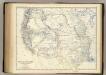
United States W.
1 : 4748000 Johnston, Alexander Keith, 1804-1871
54. Areas irrigated 1889.
1 : 7000000 Gannett, Henry, 1846-1914; United States. Census Office
Map Showing The General Topographical Features ... West of the Mississippi River.
1 : 6000000 Wheeler, G.M.
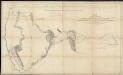
Reduced section, sketch, W. pt. of North America, 1818.
1 : 18000000 Warren, Gouverneur Kemble, 1830-1882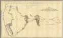
Map Of An Exploring Expedition To The Rocky Mountains.
1 : 1950000 Fremont, J.C.
Western States road map.
1 : 1362240 Standard Oil Company of California
Map Of Oregon And Upper California.
1 : 3000000 Fremont, J.C.