Maps of New Brunswick

Map of the disputed territory [Maine] : reduced from the original of Messrs. Featherstonehaugh & Mudge, British commissioners
1 : 1950000 Stone, William James
Canada East Formerly Lower Canada.
1 : 1770000 Mitchell, Samuel Augustus
[Neueste Karte von Lower Canada]
Grosser Hand-Atlas über alle Theile der Erde in 170 Karten Meyer, J. Verlag des Bibliographischen Instituts
Canada East.
1 : 1770000 Tanner, Henry S.
Lower Canada.
1 : 1770000 Tanner, Henry S.
Colton's railroad & township map of the state of Maine, with portions of New Hampshire, New Brunswick & Canada
1 : 550000 J.H. Colton & Co J.H. Colton & Co.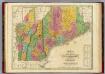
Map of Maine New Hampshire And Vermont.
1 : 990000 Finley, Anthony
Maine.
1 : 1550000 Tanner, Henry S.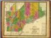
Map of Maine, New Hampshire,and Vermont.
1 : 1020000 Mitchell, Samuel Augustus
Neueste Karte von Maine
Grosser Hand-Atlas über alle Theile der Erde in 170 Karten Meyer, J. Verlag des Bibliographischen Instituts
Quebec.
1 : 2000000 Mitchell, Samuel Augustus
Quebec.
1 : 2000000 Mitchell, Samuel Augustus
Quebec.
1 : 2000000 Mitchell, Samuel Augustus Jr.
Original Thirteen Colonies.
1 : 2000000 Mitchell, Samuel Augustus Jr.
Quebec.
1 : 2000000 Mitchell, Samuel Augustus
Quebec.
1 : 2000000 Mitchell, Samuel Augustus
Maine.
1 : 2851200 Scott, Joseph
Map of the district of Maine : from the latest and best authorities
1 : 506880 Greenleaf, Moses, 1777-1834 Cummings & Hilliard
A new map of Maine. Published by Charles Desilver.7
1 : 1550000 Mitchell, Samuel Augustus
Maine.
1 : 1550000 Mitchell, Samuel Augustus
Maine.
1 : 1650000 Greenleaf, Jeremiah
Maine.
1 : 1584000 Greenleaf, Jeremiah
New Map of Maine
1 : 2000
Maine

Maine.
1 : 1710720 Carey, Mathew
Province of Maine.
1 : 1774080 Carey, Mathew
Province of Maine.
1 : 3168000 Carey, Mathew
Province of Maine.
1 : 1730000 Lewis, Samuel
Province of Maine.
1 : 1774080 Carey, Mathew
![Map of the disputed territory [Maine] : reduced from the original of Messrs. Featherstonehaugh & Mudge, British commissioners](https://images-2.georeferencer.com/images/iiif/844610652369/full/,300/0/native.jpg)

