Maps of United States
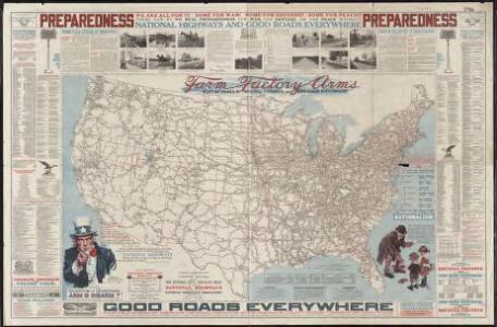
National highways map of the United States showing one hundred fifty thousand miles of national highways proposed by the National Highways Association
1 : 3800000 Mulford, John C. National Highways Association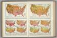
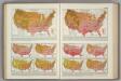
Monthly Temperature Maps: September. October. Atlas of American Agriculture.
Kincer, Joseph Burton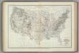
Location of Meteorological Stations. Atlas of American Agriculture.
1 : 8000000 Kincer, Joseph Burton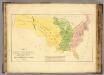
Etats-Unis de l'Amerique du Nord, l'adjonction progressive.
1 : 5000000 Buchon, J. A. C.; Carey, H. C.; Lea, I.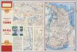
Various Regions and Cities in Alabama.
Shell Oil Company
Annual March of Significant Temperatures at Selected Stations. Atlas of American Agriculture.
1 : 8000000 Kincer, Joseph Burton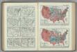
Frost Occurrences. Atlas of American Agriculture.
Reed, William Gardner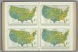
Frequency of Precipitation. Atlas of American Agriculture.
1 : 17000000 Kincer, Joseph Burton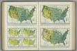
Monthly (May, June, July) Precipitation. Atlas of American Agriculture.
1 : 17000000 Kincer, Joseph Burton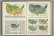
Winter Temperatures. Atlas of American Agriculture.
Kincer, Joseph Burton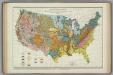
Parent Materials of Soils. Atlas of American Agriculture.
Marschner, Francis J.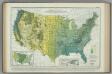
Average Annual Precipitation in Inches. Atlas of American Agriculture.
1 : 8000000 Kincer, Joseph Burton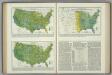
Relative Frequency of Precipitation. Atlas of American Agriculture.
1 : 17000000 Kincer, Joseph Burton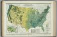
Spring Precipitation. Atlas of American Agriculture.
1 : 8000000 Marschner, Francis, J.
Mileage chart U.S.
Rand McNally and Company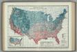
Average Dates of Last Killing Frost in Spring. Atlas of American Agriculture.
1 : 8000000 Reed, William Gardner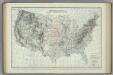
Location of Meteorological Stations. Atlas of American Agriculture.
1 : 8000000 Kincer, Joseph Burton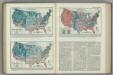
First Killing Frost .... Season (Length) without Killing Frost .... Atlas of American Agriculture.
1 : 17000000 Reed, William Gardner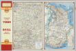
Central Ozarks.
1 : 823680 Shell Oil Company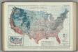
Average Dates of First Killing Frosts in Fall. Atlas of American Agriculture.
1 : 8000000 Brooks, Charles Franklin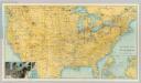
U.S. showing NY Central Lines.
1 : 3295000 Rand McNally and Company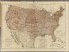
United States districts, general government surveys.
1 : 7000000 Wheeler, G.M.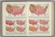
Monthly Temperature Maps: July. August. Atlas of American Agriculture.
Kincer, Joseph Burton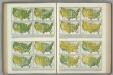
Relative Humidity, Vapor Pressure, Wet Bulb Temperature Depression. Atlas of American Agriculture.
Kincer, Joseph Burton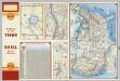
Various Regions and Cities in Oregon.
Shell Oil Company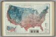
Average Number of Days without Killing Frost. Atlas of American Agriculture.
1 : 8000000 Marschner, F.J.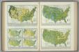
Precipitation. Precipitation Frequency. Atlas of American Agriculture.
1 : 17000000 Kincer, Joseph Burton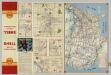
Various Regions and Cities in Oklahoma.
Shell Oil Company
Monthly Precipitation. Atlas of American Agriculture.
1 : 8000000 Kincer, Joseph Burton