Maps of United States

Vereinigte Staaten von Nord-America
1 : 13000000
Vereinigte Staaten Von Nordamerika

Etats-Unis de l'Amerique en 1860.
1 : 12000000 Garnier, F. A., 1803-1863
Map of the United States of America with its territories & districts : including also a part of upper & lower Canada and Mexico.
from Whole
United States.
1 : 10560000 Rand McNally and Company
Railroad map of the United States to accompany the "Commercial travellers guide book".
From Whole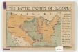
The battle fronts of Europe
1 : 2500000 Map of battle fronts drawn to scale upon a map of the United States showing relative distances of fronts. Roberts & Leete. London : Stanford's Geographical Establishment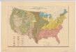
Distribution of the great soil groups (soil provinces)
1 : 8000000 Relief shown by spot heights. Appears in Washington: U.S. Dept. of Agriculture. Atlas of American agriculture, 1936. Soils, plate 2. Marbut, Curtis Fletcher, 1863-1935. Washington, D.C. : Bureau of Chemistry and Soils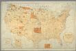
Map showing the location of the Indian reservations within the limits of the United States and territories / compiled from official and other authentic sources, under the direction of the Hon. John D.C. Atkins, Commissioner of Indian Affairs ; Paul Brodi
from Whole
United States / Geo. Boynton, sc., Boston.
from Whole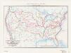
Map of the conterminous United States showing routes of the principal explorers from 1501 to 1844, whose work had an important bearing on the settlement of the country and the fixing of its successive boundaries
1 : 8500000 "Taken from Bulletin 1212, Plate 1." Original title: United States map showing routes of principal explorers and early roads and highways. Bond, Frank, 1856-1940 United States. General Land Office.; Geological Survey (U.S.); Reston, Virginia : U.S. Geological Survey
Map of the United States, constructed from the latest authorities / J.H. Young, sc.
from Whole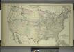
Map of the United States and Territories
from Combination atlas map of Broome County, New York; / compiled, drawn and published from personal examinations and surveys by Everts, Ensign & Everts.
Hammond's comprehensive map of the United States with portions of Canada and Mexico
1 : 5000000 C.S. Hammond & Company C.S. Hammond & Company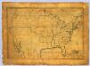
United States.
1 : 7700000 Symonds, Maria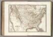
Etats-Unis d'Amerique.
1 : 9300000 Lapie, M. (Pierre), 1779-1850
Vereinigte Staaten
1 : 10000000 Nové Skotsko Elfert, Paul Geogr. anstalt von Wagner & Debes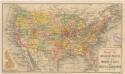
Routen der Missouri - Pacific, sowie der Wabash St. Louis und Pacific Eisenbahnen

[Vereinigte Staaten von Nord-America und Canada]
Schul-Atlas über alle Theile der Erde nach dem neuesten Zustande, und über das Weltgebäude Stieler, Adolf bei Justus Perthes
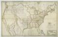
Fredonia Or The United States of North America.
1 : 570000 Laurie, Richard Holmes
Etats-Unis.
1 : 11700000 Migeon, J.
United States.
1 : 9504000 Fullarton, A. & Co.
Map of the United States and Mexico: including Oregon, Texas and the Californias.
from Parts s.n.: [New York?],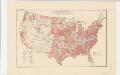
Areas covered by the soil survey, completed to January 1934
1 : 7900000 Includes numbered list of reconnaissance surveys. "Atlas of American Agriculture, Soils, Plate 1." United States. Bureau of Chemistry and Soils. [Washington, D.C.?] : The Bureau
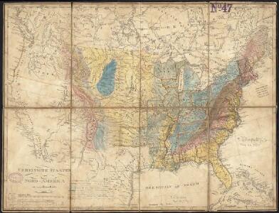
[Neuer Atlas der ganzen Erde nach den neuesten Bestimmungen ... : XXIV.] Charte von dem Nordamericanischen Staatenbunde
Entworfen und gezeichnet von F.W. Streit H. Leutemann sc. Leipzig : J.C. Hinrichs'sche Buchhandlung
United States of America.
1 : 22000000 Colton, G.W.
Vereinigte Staaten von Nord-America
Hand-Atlas über alle Theile der Erde nach dem neuesten Zustande und über das Weltgebäude Stieler, Adolf bei Justus Perthes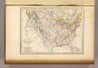
Etats-Unis d'Amerique, 1835.
1 : 16200000 Malte-Brun, Conrad, 1775-1826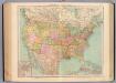
127-28. Stati Uniti.
1 : 10000000 Touring club italiano