Maps of United States
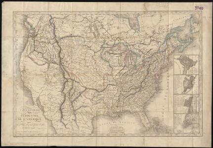
Carte générale des États-Unis de l'Amérique avec les plans des principales villes
1 : 7500000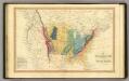
Geol. map US.
1 : 15000000 Simpkin & Marshall
Etats-Unis de l'Amerique en 1860.
1 : 12000000 Garnier, F. A., 1803-1863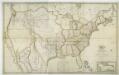
Map of the United States with the contiguous British & Spanish possessions / compiled from the latest & best authorities by John Melish; engraved by J. Vallance & H.S. Tanner.
from Whole John Melish; J. Vallance; Henry S. Tanner,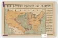
The battle fronts of Europe
1 : 2500000 Map of battle fronts drawn to scale upon a map of the United States showing relative distances of fronts. Roberts & Leete. London : Stanford's Geographical Establishment
194-195. United States of America. The World Atlas.
1 : 10000000 USSR (Union of Soviet Socialist Republics).
United States.
1 : 21000000 Grigg, John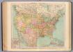
127-28. Stati Uniti.
1 : 10000000 Touring club italiano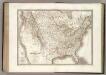
Etats-Unis d'Amerique.
1 : 9300000 Lapie, M. (Pierre), 1779-1850
Map of the United States, constructed from the latest authorities / J.H. Young, sc.
from Whole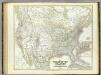
Vereinigten Staaten von N. America.
1 : 8000000 Kiepert, Heinrich, 1818-1899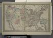
Map of The United States
from Atlas of Franklin County, New York. : From actual surveys and official records.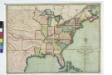
The traveller's guide : a new and correct map of the United States, including great portions of Missouri Territory, Upper & Lower Canada, Nova Scotia, New Brunswick, the Floridas, Spanish provinces &c. / collected and compiled from the most undoubted aut
from Whole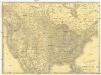
Rand McNally new official railroad map of the United States and southern Canada
1 : 5258880 Kanada Rand McNally
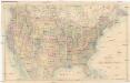
United States of America.
1 : 22000000 Colton, G.W.
North America.
1 : 8870400 Wilkinson, Robert
Vereinigte Staaten Von Nordamerika

North America from the most authentic and latest surveys.
1 : 9300000 Wilkinson, Robert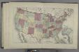
Map of the United States
from Atlas of Madison County, New York : from actual surveys / by and under the direction of D. G. Beers.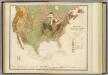
Geol. map U.S.
1 : 10000000 Rogers, Henry Darwin
Composite: Vereinigte Staaten v. Nordamerika.
1 : 8000000 Berghaus, Heinrich; Flemming, Carl; Sohr, Karl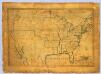
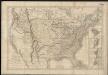
United States.
1 : 7700000 Symonds, Maria
[Vereinigte Staaten von Nord-America und Canada]
Schul-Atlas über alle Theile der Erde nach dem neuesten Zustande, und über das Weltgebäude Stieler, Adolf bei Justus Perthes
Map of the United States, British & Central America : from state documents & unpublished materials
1 : 3540000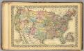
U.S., Canada.
1 : 10000000 Williams, W. (Wellington)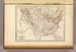
Etats-Unis d'Amerique, 1835.
1 : 16200000 Malte-Brun, Conrad, 1775-1826
Vereinigte Staaten
1 : 18500000 Severní Amerika Biller, Franz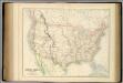
United States.
1 : 9504000 Fullarton, A. & Co.
Vereinigte Staaten
1 : 10000000 Nové Skotsko Elfert, Paul Geogr. anstalt von Wagner & Debes