Maps of United States
Fredonia or the United States of North-America : including also Cabotia, or the Canadian provinces; the Western Territory to the Pacific Ocean; and the northern part of the Mexican States
1 : 5700000
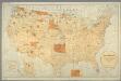
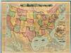
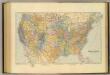
United States and territories.
1 : 2534400 U.S. General Land Office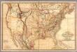
Fredonia Or The United States of North America.
1 : 570000 Laurie, Richard Holmes
Vereinigte Staaten von Amerika
1 : 6000000 Filipíny Carl Flemming
Karte der Vereinigten Staaten von Nordamerika
1 : 3000000 Aljaška Handtke, Friedrich Carl Flemming
Vereinigte Staaten Von Nordamerika
American Union Railroad Map Of The United States.
1 : 4435000 Haasis & Lubrecht
American Continent: United States, British Possessons, West Indies, Mexico, Central America
1 : 4435200 Rosa, R.
[Vereinigte Staaten von Nord-America und Canada]
Schul-Atlas über alle Theile der Erde nach dem neuesten Zustande, und über das Weltgebäude Stieler, Adolf bei Justus Perthes
Map of the United States of North America, upper & lower Canada, New Brunswick, Nova Scotia & British Columbia, Mexico, Cuba, Jamaica, St. Domingo and the Bahama Islands
1 : 5800000
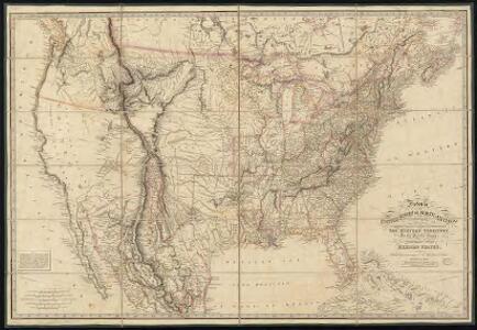
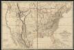
United States with the contiguous British & Spanish Possessions.
1 : 3801600 Melish, John
Composite: United States with the contiguous British & Spanish Possessions.
1 : 3801600 Melish, John
Map of the United States: with the contiguous British & Spanish possessions / compiled from the latest & best authorities by John Melish; engraved by J. Vallance & H.S. Tanner.
from Whole John Melish; J. Vallance; Henry S. Tanner,
United States of America. Pergamon World Atlas.
1 : 10000000 Polish Army Topography Service
Map of the United States, constructed from the latest authorities / J.H. Young, sc.
from Whole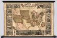
Pictorial Map Of The United States.
1 : 6336000 Atwood, J.M.; Ensign & Thayer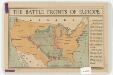
The battle fronts of Europe
1 : 2500000 Map of battle fronts drawn to scale upon a map of the United States showing relative distances of fronts. Roberts & Leete. London : Stanford's Geographical Establishment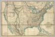
Fredonia Or The United States of North America.
1 : 570000 Laurie, Richard Holmes
A new map of the United States of America
1 : 8750000 Facsimile. "The United States in 1856 as reproduced by Rand McNally & Company to commemorate its one hundredth anniversary in 1956." Relief shown by hachures. Shows railroad routes proposed to the Pacific Ocean. Includes insets: Gold region of California and District of Columbia. Longitude on top of map "West from Greenwich;" on bottom "East/West from Washington." Printed with ornamental border. "Entered according to Act of Congress in the year 1856 by Charles Desilver, in the Clerks office of the District court of the Eastern District of Pennsylvania." Screen reader support enabled. Young, J. H. (James Hamilton) Philadelphia : Published by Charles Desilver, 1856. ([Chicago] : Rand Mcnally 1956)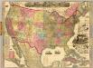
The American Republic and rail-road map of the United States.
1 : 4435200 Watson, Gaylord
Etats Unis.
1 : 10000000 Vivien St Martin, L.
Verso: American Airlines system map.
American Airlines, inc.
American Airlines system map.
1 : 6336000 American Airlines, inc.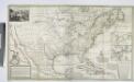
A new map of the north parts of America claimed by France under ye names of Louisiana, Mississipi, Canada and New France, with ye adjoyning territories of England and Spain ... / by H. Moll, geographer, 1720.
from Charts and maps Herman Moll,
A new map of the north parts of America claimed by France under ye names of Louisiana, Mississipi, Canada and New France, with ye adjoyning territories of England and Spain ... / by H. Moll, geographer, 1720.
from Charts and maps Herman Moll,
Atlas für Handel und Industrie: Für Kaufleute, Fabrikante u. Gewerbetreibende, Handlungs- u. Gewerbe-Schulen
United States.
1 : 7603200 Stanford, Edward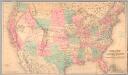
Railroad map of the United States to accompany the "Commercial travellers guide book".
From Whole
Vereinigte Staaten
1 : 10000000 Nové Skotsko Elfert, Paul Geogr. anstalt von Wagner & Debes