Maps of West Indies
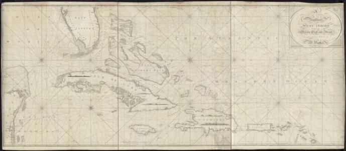
A new chart of the West Indies including the Florida Gulf and Stream
Heather, W. (William) Heather, W. (William)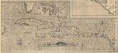
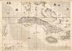
Hispaniolae, Cubae, Aliarumque Insularum Circumiacientium, Delineatio [Karte], in: Theatrum orbis terrarum, S. 70.
1 Karte aus Atlas Ortelius, Abraham Vrients, Jan Baptista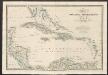
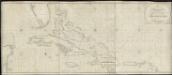
West India & Bahama Islands
A new general atlas of modern geography, consisting of a complete collection of maps of the four quarters of the globe Wyld, James James Wyld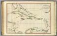
West India Islands.
1 : 4400000 Faden, William, 1750?-1836
West Indies.
1 : 20000000 Fenner, Rest.
West Indies.
1 : 10137600 Lucas, Fielding Jr.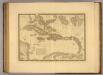
Iles Antilles ou des Indes Occidentales.
1 : 5750000 Picquet, C.
West Indies.
1 : 11000000 Tanner, Henry S.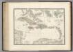
Iles Antilles, Indes Occidentales.
1 : 6000000 Levasseur, E.
West Indies.
1 : 7300000 Mitchell, Samuel Augustus
West Indies.
1 : 6550000 Rand McNally and Company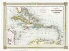
Antilles ou Indes Occidentales
1 : 1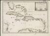
Les isles Antilles &c. entre lesquelles sont les Lucayes, et les Caribes
1 : 1
West India islands.
1 : 9000000 Morse, Sidney E. (Sidney Edwards), 1794-1871
West Indies.
1 : 6336000 Rand McNally and Company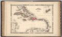
West Indies.
1 : 6569000 Johnson, A.J.
West Indies.
1 : 7450000 Tanner, Henry S.
West Indies.
1 : 7450000 Tanner, Henry S.
West Indies.
1 : 11400000 Cummings, J. A. (Jacob Abbot)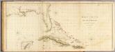
West Indies 1.
1 : 2900000 Arrowsmith, Aaron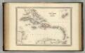
West Indies.
1 : 5800000 Johnson, A.J.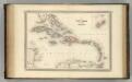
West Indies.
1 : 5800000 Johnson, A.J.
West Indies.
1 : 6500000 Rand McNally and Company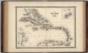
West Indies.
1 : 5800000 Johnson, A.J.
Grossen Antillen.
1 : 6000000 Radefeld, Carl Christian Franz, 1788-1874
Insularaum Hispaniolae et Cubae Cum Insulis circum jacentibus accurata delinatio. [Karte], in: Novus atlas absolutissimus, Bd. 9, S. 65.
1 Karte aus Atlas Janssonius Offizin
Neueste Karte der Grossen Antillen
Grosser Hand-Atlas über alle Theile der Erde in 170 Karten Meyer, J. Verlag des Bibliographischen Instituts
Insularum Hispaniolae et Cubae Cum Insulis circum iacentibus accurata delineatio. [Karte], in: Het vijfde Deel Des Grooten Atlas : Vervatende De Water-Weereld, S. 63.
1 Karte aus Atlas Jansson, Jan Jansson, Jan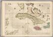
A Map of the British Empire in America. (Sheet 14).
1 : 2000000 Popple, Henry