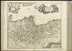
Maps of Götaland
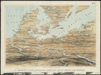
Stannard & Son's, panoramic birds-eye view, of Berlin & its defences, the principal Prussian ports on the Baltic, with Denmark and Schleswig Holstein
1 : 1
II. 1440 - 1608
Brandenburg Expansion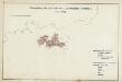
I. Brandenburg bis zum Tode des 1. Zollernfürsten Friedrich I. 1134 - 1440
Brandenburg Friedrich I., Brandenburg, Kurfürst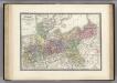
Prussienne.
1 : 2400000 Levasseur, E.
Nordöstliches Central-Europa
Ostmitteleuropa
Daniae Regni Typus. [Karte], in: Theatrum orbis terrarum, S. 56.
1 Karte aus Atlas Ortelius, Abraham
[Daenemark mit Schleswig, Holstein, und Lauenburg; Island u. Fär-Öer]
Schul-Atlas über alle Theile der Erde nach dem neuesten Zustande, und über das Weltgebäude Stieler, Adolf Justus Perthes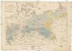
Karte vom Preussischen Staate
Prusko Döring, F. von Schropp, Simon Simon Schropp et Comp.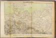
Nord-Deutschland.
1 : 1700000 Ziegler, J. M.
Prussia.
1 : 1628000 Johnson, A.J.
Daniae Regni Typus. [Karte], in: Theatrum orbis terrarum, S. 204.
1 Karte aus Atlas Ortelius, Abraham Vrients, Jan Baptista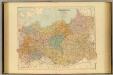
German Empire E, Poland.
1 : 1584000 Stanford, Edward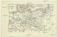
Zur Geschichte Friedrichs des Grossen
Evropa střední R. Gaertner
Prussia.
1 : 3400000 Finley, Anthony
Prussia and Saxony.
1 : 3000000 Colton, G.W.
Germany, Prussia and Saxony.
1 : 2500000 Colton, G.W.
Prussia and Saxony.
1 : 3000000 Colton, G.W.
Carte réduite de la mer Baltique, 1
1 Blatt : 73 x 60 cm Froullé
Prussia And Saxony.
1 : 2661120 Colton, G.W.
Prussia.
1 : 3300000 Tanner, Henry S.
Prussia.
1 : 2650000 Hughes, William
Germany No.1, Prussia and Saxony.
1 : 2500000 Colton, G.W.
Prussia and Saxony.
1 : 3000000 Colton, G.W.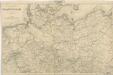
Reisekarte von Nord - Deutschland

Situation des armées Francaises depuis le 10 mars jusqu'á la bataille de Wurtchen (Campagne de 1813)
1 : 2281000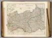
Prussia & Poland.
1 : 1584000 Arrowsmith, John
Generale-Charte der Preussischen Monarchie in zwey Blättern
1 : 1030000 Prusko Streit, Friedrich Wilhelm Gilly Geograph. Institut
Danemark vizt Jutland, Zeland, Sleswick, Holstein.
from A new systeme of the mathematicks: containing I. Arithmetick, as well natural and decimal, as in species, or the principles of algebra. II. Practical geometry, together with the first six books of Euclid's Elements, as also the eleventh and twelfth, symbo
(Le Danemarck)
1 : 5000000 Bruyset, Jean-Marie; Schneider, J. H.