Maps of Senegal
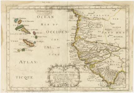
Isles de Cap Verd coste, et pays des Negres
1 : 1
Isles de Cap Verd coste, et pays des Negres
1 : 1
Bocche del Fiume Negro et Isole di Capo Verde
1 : 1
Carte de l'Afrique Françoise ou du Sénégal, dressée sur un grand nombre de cartes manuscrites et d'itineraires rectifiés par diverses observations
1 : 3000000
Genehoa, Jaloffi, et Sierraliones Regna. [Karte], in: Novus atlas absolutissimus, Bd. 6, S. 174.
1 Karte aus Atlas Janssonius Offizin
Carte de la cote occidentale de l'Afrique
1 : 4000000 Herbin de Halle, Etienne de.
Carte géologique de l'Afrique occidentale française au 1 000 000e
1 : 1000000 Dakar (Senegal) Hubert, Henry Émile Larose
W. coast Africa.
1 : 1850000 Sayer, Robert
Composite: Afrique occidentale
1 : 1320000 Anville, Jean Baptiste Bourguignon d, 1697-1782
Map of the Gambia with the coast & country adjoining : to accompany Dr. Madden's report
1 : 2500000 John Arrowsmith, lith. [London] : James & Luke J. Hansard, printers
Carte de l'Afrique occidentale française. Dakar
1 : 2000000 France. Service géographique des colonies [Paris] : Service géographique des colonies
Specialkarte der West-Kϋste von Africa von Cabo Blanco bis Cabo Verga
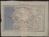
Sénégal
1 : 2000000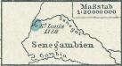
[Senegambien]
1 : 30000000 Senegambien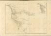

Senegal. Afrique 19.
1 : 1641836 Vandermaelen, Philippe, 1795-1869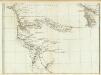
Carte particuliere de la Cote occidentale de l'Afrique, depuis le Cap Blanc jusqu'au Cap de Verga. (Southern section)
1 : 1320000 Anville, Jean Baptiste Bourguignon d, 1697-1782
Charte von Bambuk
1 : 2900000 Mali Compagnons
CHARTE von BAMBUK
1 : 2900000 Mali Compagnon
Carte des isles du Cap-Verd
1 : 1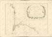
Atlantic islands.
Thomson, John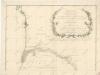
Specialkarte der West-Kϋste von Africa von Cabo Blanco bis Cabo Verga

Iles du Cap Vert. Afrique 18 bis.
1 : 1641836 Vandermaelen, Philippe, 1795-1869
A new chart of the Cape Verd Islands, from the latest authorities
1 : 950000 Heather, W. (William) Heather, W. (William)
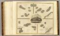
Isles Du Cap-Verd = Die Inseln von Capo Verde
1 : 350000
Insulae De Cabo Verde, Olim Hesperides, Sive Gorgades: Belgice De Zoute Eylanden. [Karte], in: Novus atlas absolutissimus, Bd. 9, S. 250.
1 Karte aus Atlas Janssonius Offizin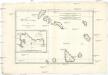
Isles du Cap-Verd
1 : 1200000 Kapverdy Bonne, Rigobert André
Cape Verd Ids.
1 : 1158582 Lucas, Fielding Jr.