Maps of Altiplano

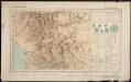
Richard Mayer's commercial map of Northern Chili, Bolivia, & southern Peru
1 : 1000000
Central Andes. Pergamon World Atlas.
1 : 5000000 Polish Army Topography Service
West Coast of South America.
Fullarton, A. & Co.
South America 3.
1 : 2800000 Arrowsmith, Aaron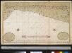
Een gedeelte van de Zuijdt-Zee van Quilca tot Po. El Guasco geleegen aen de kust van Peru
Chile Gerard van Keulen
Partie du Perou. Amer. Merid. 25.
1 : 1641836 Vandermaelen, Philippe, 1795-1869
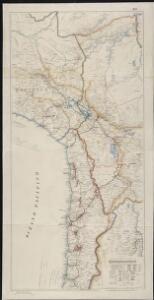
West Coast of South America. Peru and Bolivia (mostly Chile) ... Quilca to Cobija.
1 : 1230000 Berghaus, Henry
Mapa del sur del Peru y parte de Bolivia
1 : 1000000 Arequipa : J.L. Villanueva
Departamento de Cuzco.
1 : 1090000 Paz Soldan, Mariano Felipe, 1821-1886
La Paz : South America, 1:1,000,000
1 : 1000000
Puno - Rio Beni : South America, 1:1,000,000
1 : 1000000
Carte des Provinces de Salta et de Jujuy et d'une partie de la Bolivie
1 : 2000000 Description géographique et statistique de la Confédération Argentine Martin de Moussy, Victor Librairie de Firmin Didot frères, fils et Cie
Carta de la rejion salitrera comprendida entre los paralelos 19° y 27°30' lat. sur
1 : 500000 (Chili) Delegacion fiscal de salitreras Antofagasta : Delegacion fiscal de salitreras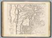
Carte, provinces de Salta et Jujuy, partie de la Bolivie.
1 : 1850000 Martin de Moussy, V. (Victor), 1810-1869
Departamento de Moquegua.
1 : 1080000 Paz Soldan, Mariano Felipe, 1821-1886
Partie du Chili. Amer. Merid. 29.
1 : 1641836 Vandermaelen, Philippe, 1795-1869
Partie du Perou. Amer. Merid. 20.
1 : 1641836 Vandermaelen, Philippe, 1795-1869
Catamarca et Tucuman.
1 : 1850000 Martin de Moussy, V. (Victor), 1810-1869
Carte des Provinces de Catamarca de Rucuman et des régions voisines
1 : 2000000 Description géographique et statistique de la Confédération Argentine Martin de Moussy, Victor Librairie de Firmin Didot frères, fils et Cie
Partie du Perou. Amer. Merid. 21.
1 : 1641836 Vandermaelen, Philippe, 1795-1869
Partie, Perou, Bresil. Amer. Merid. 15.
1 : 1641836 Vandermaelen, Philippe, 1795-1869
Departamento de Puno.
1 : 1090000 Paz Soldan, Mariano Felipe, 1821-1886
(Mapa de la Republica de Chile 2)
1 : 11000000 Pissis, Aime, 1812-1889
Departamento de Arequipa.
1 : 1100000 Paz Soldan, Mariano Felipe, 1821-1886
Mapa de la Republica de Chile (1)
1 : 11000000 Pissis, Aime, 1812-1889
Demarcacion de limites con Chile. Puna de Atacama.
1 : 500000 Argentine. Oficina de Límites Internacionales [Buenos Aires ?] :
Cote, Perou.
1 : 830000 Lartigue, Joseph, 1791-1876
Corte geologico de la parte sud del Peru.
Paz Soldan, Mariano Felipe, 1821-1886
Departamento de Ayacucho.
1 : 1080000 Paz Soldan, Mariano Felipe, 1821-1886